


CLEVELAND — If you are hoping for some relief from the heat...you are in luck! It is noticeably cooler today after a cold front swept through the region, bringing a very soggy start to your Thursday. We are already so much drier for the rest of the night. A stray shower or two cannot be ruled out tonight and into Friday, but this looks very isolated; most will stay dry.
Friday will also be a touch breezy with NE winds 10 to 15 mph. The breezy winds over the last day will make Lake Erie choppy and dangerous. There is a high risk for rip currents through Friday afternoon
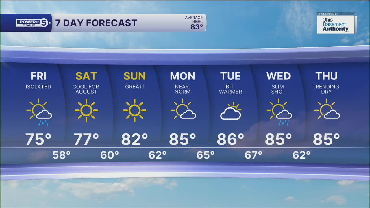
As high pressure builds into NEO, we are already seeing fewer clouds. Plan for tons of sunshine Friday and throughout the weekend. The cold front also lived up to its name and has brought significantly cooler and less humid air. The weekend looks FANTASTIC - dry, not too hot or humid!
We start to warm back up by early next week, with temperatures in the mid-80s. As for rain chances, they look very minimal for the next week...or more!
DAILY FORECAST:
Thursday Night: Clearing clouds, cool.| Low: 58º
Friday: Much drier, comfortable, and breezy. | High: 75º
Saturday: Sunny and pleasant. | High: 77º
Sunday: Sunny & Mild. | High: 82º
Monday: Warmer temps, still dry. | High: 85º
Download the News 5 app for the latest weather updates:
Follow the News 5 Weather Team:
Trent Magill: Facebook & Twitter
Katie McGraw: Facebook & Twitter
Phil Sakal: Facebook & Twitter
