


CLEVELAND — The sub-zero wind chills have been around all day Saturday and to start off Sunday morning. A Cold Weather Advisory expires at 10 a.m. Sunday for most areas east of I-77, where the temperature and wind combination have made it feel like 15 below zero. This does not include Cleveland or Akron. That is despite lows reaching -7 in Cleveland and -10 in Akron, the coldest of the week, and the second coldest of the winter so far.
A very weak clipper missed the area to the west, as forecast, avoiding any additional accumulation this morning. More sunshine, yet highs only 'warm' into the mid to upper teens this afternoon, with single-digit wind chills.
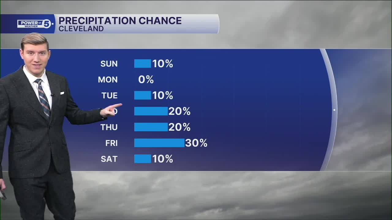
Highs will rebound, above freezing, for the first time in 19 days on Tuesday. Monday will be a transition day with highs into the upper 20s with increasing clouds. A warm front is expected to be mostly dry, but a brief round of freezing drizzle can't be ruled out, especially near the lakeshore. Any storms the rest of the week are likely to be weaker, with minimal chances for precipitation midweek before a better chance for Valentine's weekend.
DAILY FORECAST:
Sunday: Frigid again. Partly to mostly sunny. | High: 18º
Monday: Warmer. Partly to mostly cloudy. | High: 28º
Tuesday: Mostly cloudy. Seasonable. | High: 38º
Wednesday: Mostly cloudy. | High: 32º
Thursday: Snow showers possible. Below freezing again. | High: 29º
Friday: Snow showers possible. Cold. | High: 29º
Want the latest Power of 5 weather team updates wherever you go? Download the News 5 App free now: Apple|Android
Click here to view our interactive radar.
Follow the News 5 Weather Team:
Trent Magill: Facebook & Twitter
Katie McGraw: Facebook & Twitter
Phil Sakal: Facebook & Twitter
Allan Nosoff: Facebook & Twitter
