


CLEVELAND — After another brutally cold start with lows near 0º and wind chills as low as -20º, it has rebounded significantly this afternoon. Highs soared to 31º in Cleveland, juuust shy of the freezing mark, making it 18 straight days of sub-freezing temps. Still cold, but it's progress. And there's even more progress on the way.
Our first day above 32º is tomorrow. The first time above freezing in 19 days. That's where the streak ends, at 18, and the longest since 2015, which had 19 straight sub-freezing days.
Tomorrow's 40º will feel relatively nice, but it'll be breezy, and clouds will be rolling in.
Those clouds are in advance of the chill coming back. Winds shift, and temps take a dive midweek. We're back subfreezing with lake effect snow Wednesday through early Thursday with a couple of inches possible, mainly in the primary snowbelt.
DAILY FORECAST:
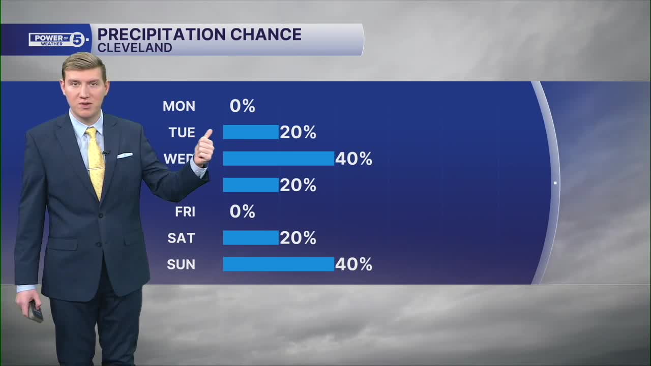
Tonight: Mostly cloudy. Stray freezing drizzle at the lakeshore. | Low: 19º (and rising late)
Tuesday: Breezy & warmer... Finally above 32º! | High: 40º
Wednesday: Mostly cloudy with a few lake effect snow showers. | High: 29º
Thursday: Isolated lake effect snow. | High: 27º
Friday: Looking dry but chilly. | High: 28º
Saturday: Slim shot at snow showers. | High: 33º
Sunday: Milder but rain/snow possible. | High: 36º
Want the latest Power of 5 weather team updates wherever you go? Download the News 5 App free now: Apple|Android
Click here to view our interactive radar.
Follow the News 5 Weather Team:
Trent Magill: Facebook & Twitter
Katie McGraw: Facebook & Twitter
Phil Sakal: Facebook & Twitter
Allan Nosoff: Facebook & Twitter
