


CLEVELAND — Clouds are back in style for tonight across NEO. While the sunshine was nice on Tuesday afternoon, the clouds will prevent our temperatures from plummeting like they did last night. It will still be chilly. Out the door temperatures early on Wednesday will be in the mid 30s, but that is a big increase from Tuesday morning, when lows were in the teens!
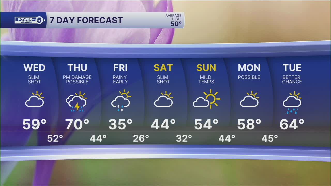
That warming trend will also be noticeable for everyone on Wednesday afternoon. As winds become more southerly at 5 to 10 mph, it will keep the cold air over the lake. Meaning temps will be allowed to SOAR. We are all in the upper 50s and low 60s with only a slim shower chance.
Temps keep climbing on Thursday...70s are possible! But then our next system rolls through. This is a replay of last Sunday & Monday. A cold front will drop our temperatures from 70º on Thursday to the 30s by Friday. With that big change, we also need to plan for storms on Thursday. Some storms could become strong or severe by late afternoon/evening on Thursday before ushering in another blast of cold temperatures.
DAILY FORECAST:
Tonight: Clouds increase, chilly but not as cold as last night. | Low: 33º
Wednesday: More clouds but milder temps. | High: 59º
Thursday: Warm & breezy with strong storms building late. | High: 70º
Friday: Few lingering showers early as temps dive. | High: 35º
Saturday: Mostly cloudy and still chilly. | High: 44º
Sunday: Milder again. | High: 54º
Want the latest Power of 5 weather team updates wherever you go? Download the News 5 App free now: Apple|Android
Click here to view our interactive radar.
Follow the News 5 Weather Team:
Trent Magill: Facebook & Twitter
Katie McGraw: Facebook & Twitter
Phil Sakal: Facebook & Twitter
Allan Nosoff: Facebook & Twitter
