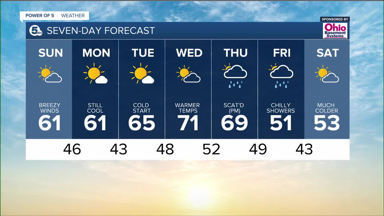


CLEVELAND — The remnants of Hurricane Ian brought clouds and wind and a few showers to northeast Ohio this weekend. This system is much weaker today and exciting the area. It is still gusty this morning, but winds will decrease gradually by tonight and into Monday morning.
Clouds will also be decreasing by this afternoon. While it was a mild start to the day, highs will stall in the upper 50s and lower 60s during the afternoon. It remains below average on Monday, but temperatures will slowly rise to the low 70s by mid-week.
The warm up is brief though! Temperatures will crash again by next weekend.
What To Expect:
- Wind gusts 20-30 mph possible Sunday
- Highs in the upper 50s & 60s
- Sun returns on Sunday
- Chilly temperatures Sunday night
- Milder mid-week!
Daily Breakdown:
Sunday: Drier with decreasing clouds. Blustery. | High: 61º
Monday: Few clouds. Cool | High: 61º
Tuesday: Lots of sunshine. | High: 64º
Wednesday: Seventies!! | High: 72º
Thursday: PM showers. | High: 64º
Friday: Isolated showers. MUCH COLDER! | High: 52º
Download the News 5 app for the latest weather updates:
Follow the News 5 Weather Team:
Mark Johnson: Facebook & Twitter
Trent Magill: Facebook & Twitter
Katie McGraw: Facebook & Twitter
