


CLEVELAND — The extreme cold is moving in overnight, with a brief break in the snow. Dangerous cold will be around all day Tuesday, with another opportunity for more accumulating snow.
The lake effect snow in the snowbelt was as-advertised on Monday, with up to four inches in areas like Waite Hill in Geauga County. Tuesday's snow will be from a clipper and arctic front. Before the snow, the extreme cold will greet Ohioans first.
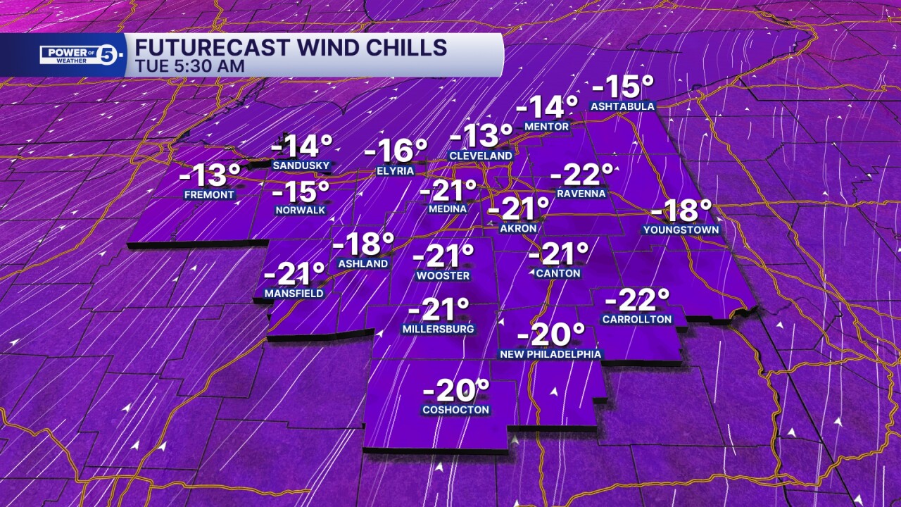
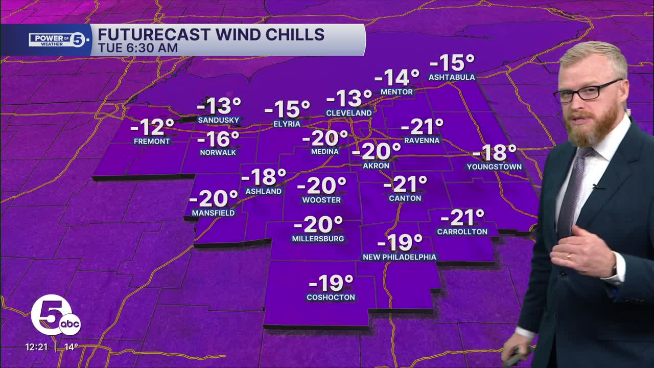
Extreme Cold Warnings are in effect for early Tuesday morning. Wind chills could drop to near -25º. It will stay sub-zero for wind chills through the day. Midnight to midnight. And right back to -20 to -30 wind chills for Wednesday morning.
As for the snow, a quick coating to an inch is possible mid-to-late morning with a clipper, and then a couple quick inches with scattered snow squalls during the afternoon with another arctic front.
DAILY FORECAST:
Tonight: Calm early, windy late. Extreme Cold Warnings: Low: 0º | Wind Chill: -20º to -30º
Tuesday: Partly Sunny and dangerously cold with a few snow showers and squalls. | High: 16º
Wednesday: Isolated snow chances, staying frigid. | High: 13º
Thursday: Isolated snow possible & frigid | High: 14º
Friday: Isolated snow showers possible, cold. | High: 8º
Want the latest Power of 5 weather team updates wherever you go? Download the News 5 App free now: Apple|Android
Click here to view our interactive radar.
Follow the News 5 Weather Team:
Trent Magill: Facebook & Twitter
Katie McGraw: Facebook & Twitter
Phil Sakal: Facebook & Twitter
Allan Nosoff: Facebook & Twitter
