


CLEVELAND — After a wild, wet, and windy Wednesday, our focus shifts to winter returning!
Four days in the 70s are gone (for now), and chilly temperatures have taken over. It's freezing with 20-30 degree wind chills!
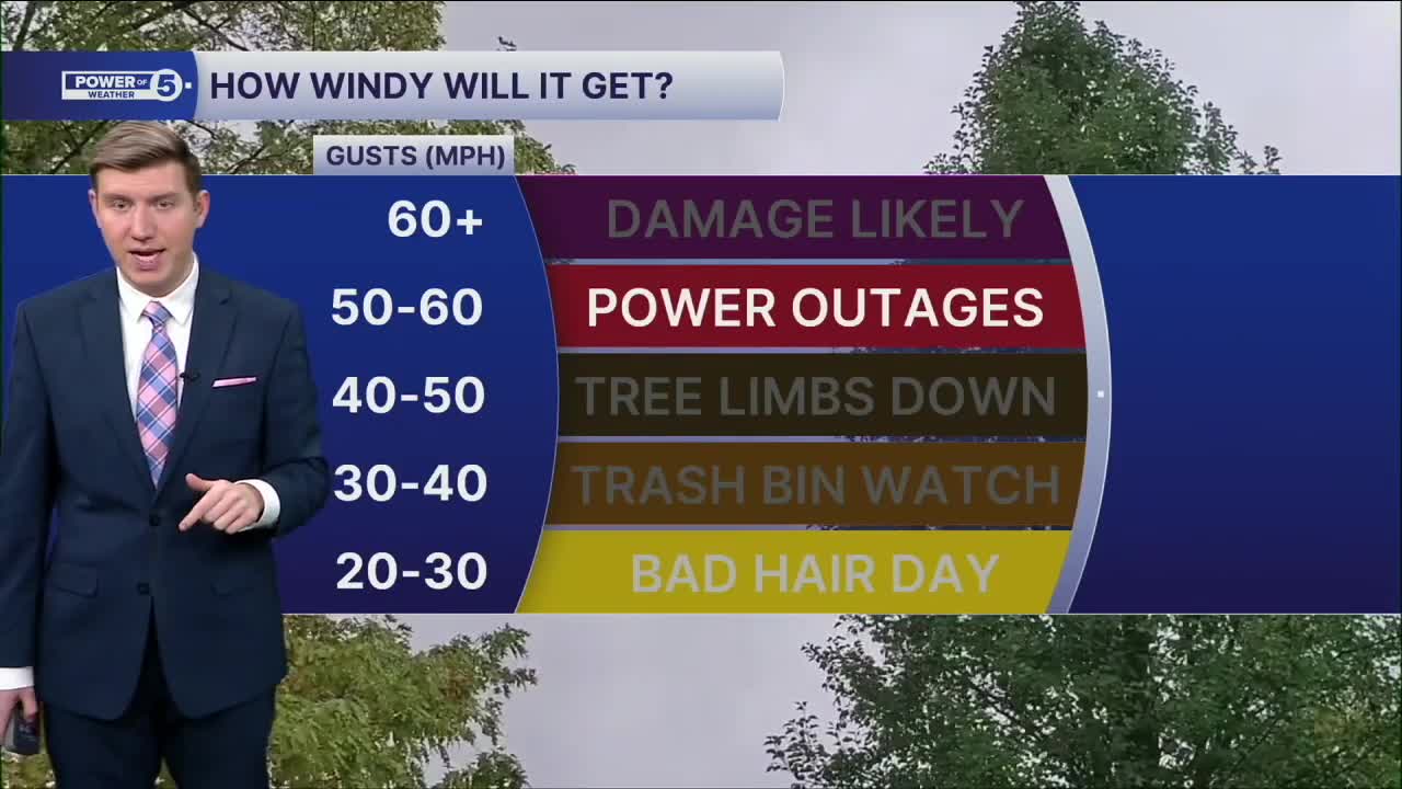
Friday is a BIG focus. Wind. Some of the gusts will be over 50mph. That's enough for debris, downed trees, and power outages. Travel will be impacted also. Plan for wind AND rain/snow showers. Temperatures will range with a few showers in the forecast. That means wet or slick roads in addition to the wind.
It's gone by the weekend.
Speaking of the weekend, you should get plenty of dry time, but we are tracking a few snow showers Saturday night, along with storms Sunday evening.
DAILY FORECAST:
Thursday: Much colder. Isolated flakes. | High: 37º
Friday: Isolated showers, very windy. Warmer. | High: 50º
Saturday: Seasonable, mainly dry. | High: 42º
Sunday: Warm & windy before storms return. | High: 65º
Want the latest Power of 5 weather team updates wherever you go? Download the News 5 App free now: Apple|Android
Click here to view our interactive radar.
Follow the News 5 Weather Team:
Trent Magill: Facebook & Twitter
Katie McGraw: Facebook & Twitter
Phil Sakal: Facebook & Twitter
Allan Nosoff: Facebook & Twitter
