


CLEVELAND — High Wind Warnings expired for everyone overnight as winds continue to decrease slowly and will become calm by Saturday afternoon.
The system that rolled through on Friday and brought the intense winds also dropped our temperatures.
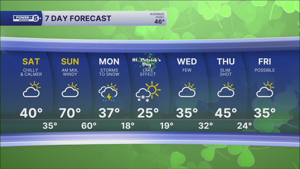
Friday night was frigid! Lows were around freezing, with breezy winds around 15 to 20 mph. It will feel even colder out the door early on Saturday.
Plan for wind chills in the teens Saturday morning, and chilly temperatures will linger...for only one day!
Temperatures jump from the 40s on Saturday afternoon to the 70s on Sunday afternoon. Gusty winds will return with the warmth (but not as strong as Friday).
The yo-yo temperature trend continues as the rebound on Sunday is only one day, too.
Next week starts ROUGH! The next system will bring gusty winds and storms by early Monday morning. As temperatures crash, storms will change to snow by the end of Monday and into St. Patrick's Day.
If you are getting your green on for the St. Paddy's Day parade, plan to dress VERY warm!
DAILY FORECAST:
Saturday: Cold with MORE sun and LESS wind. | High: 39º
Sunday: Warm & windy before storms return. | High: 65º
Monday: Heavy rain, strong wind, dropping temps... taking over late. | Temps: 50s -> 30s
St. Patrick's Day: Frigid with lake effect snow. | High: 27º
Want the latest Power of 5 weather team updates wherever you go? Download the News 5 App free now: Apple|Android
Click here to view our interactive radar.
Follow the News 5 Weather Team:
Trent Magill: Facebook & Twitter
Katie McGraw: Facebook & Twitter
Phil Sakal: Facebook & Twitter
Allan Nosoff: Facebook & Twitter
