


CLEVELAND — The sub-zero wind chills are back across all of Northern Ohio with a Cold Weather Advisory in effect through 10 AM Sunday for most areas along and east of I-77. This does not include Cleveland or Akron. Temperatures will be around Zero or a couple of degrees below zero in the eastern half of our communities. This will be coupled with winds of 10 to 15 mph, will make it feel like -10° to -15° at times.
Another weak clipper moves in by Sunday morning but should stay safe enough west to avoid bringing any additional accumulation Sunday morning. Temperatures will once again be frigid, as highs only 'warm' into the mid to upper teens Sunday afternoon, with sub-zero wind chills at times.
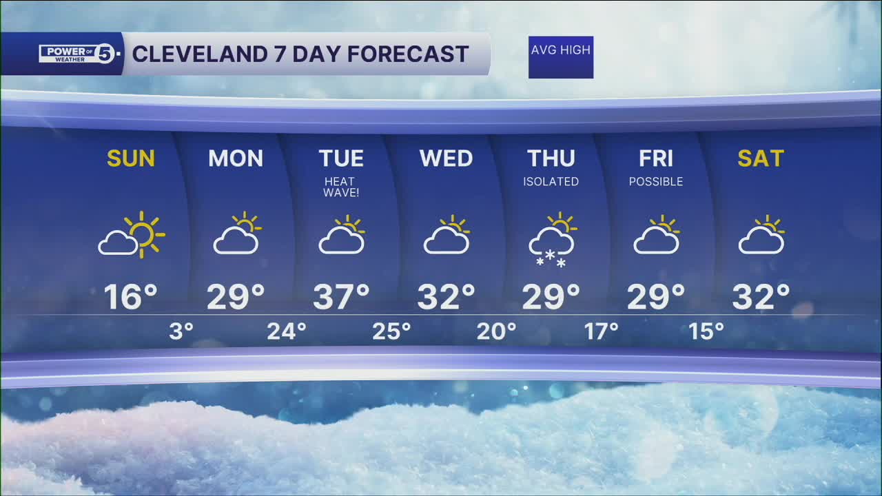
Highs will rebound, above freezing, for the first time in nearly 20 days on Tuesday. Any storms look to be weak, minimal chances for precipitation midweek before a better chance by the end of the workweek.
DAILY FORECAST:
Sunday: Frigid again. Partly to mostly sunny. | High: 16º
Monday: Warmer. Mostly cloudy. | High: 29º
Tuesday: Mostly cloudy. Seasonable. | High: 37º
Wednesday: Mostly cloudy. | High: 32º
Thursday: Snow showers possible. Below freezing again. | High: 29º
Friday: Snow showers possible. Cold. | High: 29º
Want the latest Power of 5 weather team updates wherever you go? Download the News 5 App free now: Apple|Android
Click here to view our interactive radar.
Follow the News 5 Weather Team:
Trent Magill: Facebook & Twitter
Katie McGraw: Facebook & Twitter
Phil Sakal: Facebook & Twitter
Allan Nosoff: Facebook & Twitter
