


CLEVELAND — After a wild, wet, and windy Wednesday, our focus shifts to winter returning!
Four days in the 70s are gone (for now), and chilly temperatures return for Thursday. Out the door, it will be freezing! Winds should remain breezy overnight out of the west, which will make it feel even colder! Wind chills will be in the 20s.
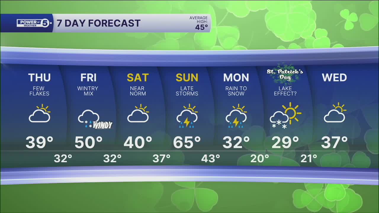
The worst of the rain has ended, but with any lingering moisture and falling temperatures, a few flakes are possible on Thursday! Highs will only be in the upper 30s and low 40s tomorrow.
Temperatures will try to rebound on Friday with highs closer to 50 degrees, but the winds will be howling! Gusts over 40 mph are expected. Winds will subside by the weekend.
Speaking of the weekend, you should get plenty of dry time, but we are tracking a few snow showers Saturday night, along with storms Sunday evening.
DAILY FORECAST:
Wednesday Night: Cold air rushing in. | High: 68º
Thursday: Much colder. Isolated flakes. | High: 37º
Friday: Isolated showers, very windy. Warmer. | High: 50º
Saturday: Seasonable, mainly dry. | High: 42º
Sunday: Warm & windy before storms return. | High: 65º
Want the latest Power of 5 weather team updates wherever you go? Download the News 5 App free now: Apple|Android
Click here to view our interactive radar.
Follow the News 5 Weather Team:
Trent Magill: Facebook & Twitter
Katie McGraw: Facebook & Twitter
Phil Sakal: Facebook & Twitter
Allan Nosoff: Facebook & Twitter
