


CLEVELAND — As a warm front approaches the area, temperatures will actually rise Saturday night and continue to climb Sunday morning. With no lake breeze for the first half of Sunday, nearly everyone in our viewing area will surge into the 60s to near-70 by noon. Then, the lake breeze returns and knocks the lakeshore temperatures back down.
A new system will bring another windy, warm, and unsettled day with strong storms possible on Sunday, before ... (can you guess?) another temperature drop on Monday, and a chance for lake effect snow showers for the morning commute.
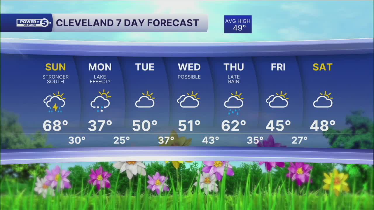
DAILY FORECAST:
Sunday: Windy, warmer, more storms late. Could be strong. 75-85 inland. | High: 68º
Monday: Mostly cloudy. Isolated flakes. Colder. | High: 37º
Tuesday: More sunshine. Seasonable. | High: 50º
Wednesday: Mostly cloudy. | High: 51º
Want the latest Power of 5 weather team updates wherever you go? Download the News 5 App free now: Apple|Android
Click here to view our interactive radar.
Follow the News 5 Weather Team:
Trent Magill: Facebook & Twitter
Katie McGraw: Facebook & Twitter
Phil Sakal: Facebook & Twitter
Allan Nosoff: Facebook & Twitter
