


CLEVELAND — We are heating up across NEO, and the storms will fire back up tomorrow!
Clouds will stick around during the overnight, along with warmer temperatures. Most areas will barely drop, hanging out in the lower 50s.
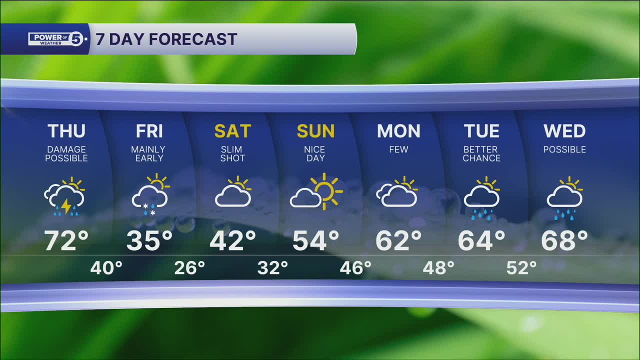
Temps keep climbing on Thursday...70s are possible!
But then our next system rolls through. This is a replay of last Sunday & Monday. A cold front will drop our temperatures from 70º on Thursday to the 30s by Friday. With that big change, we also need to plan for storms on Thursday.
Some storms could become strong or severe by Thursday evening. Heavy rain, damaging winds, large hail, and even a couple of tornadoes will be possible.
This system will then usher in another blast of cold temperatures and a couple of flakes on Friday...before ANOTHER warming trend over the weekend!
DAILY FORECAST:
Wednesday Night: Cloudy and mild. | Low: 52º
Thursday: Warm & breezy with strong storms building late. | High: 72º
Friday: Few lingering showers early as temps dive. | High: 35º
Saturday: Isolated early shower. Mostly cloudy and still chilly. | High: 42º
Sunday: Milder again. More sunshine. | High: 54º
Monday: Warmer again. Showers possible. | High: 62º
Tuesday: Better shot at rain. Touch warmer. | High: 64º
Want the latest Power of 5 weather team updates wherever you go? Download the News 5 App free now: Apple|Android
Click here to view our interactive radar.
Follow the News 5 Weather Team:
Trent Magill: Facebook & Twitter
Katie McGraw: Facebook & Twitter
Phil Sakal: Facebook & Twitter
Allan Nosoff: Facebook & Twitter
