


CLEVELAND — A little light rain south US-30 on Sunday morning didn't stop the temperatures from climbing back to the 50s for a second straight day inland, with 50° in Cleveland for the first time since Tuesday.
Monday, Presidents' Day, is even better. Once the morning fog fades, it will be mainly sunny and warmer. Most of us will soar into the 50s. Melting even more of that snowpack. The snow that is left is so slushy, too. More wet than frozen.
There is dense fog likely that will impact travel Monday morning, read more here: https://www.news5cleveland.com/weather/weather-news/dense-fog-advisory-issued-for-most-of-northern-ohio
Lake Erie is following suit. Down to under 91% ice concentration with even more danger ahead. It will be in the 50s for most of this upcoming workweek. Wind and rain midweek, with thunder possible on Wednesday.
Enjoy this thaw, but don't forget, it's still February!
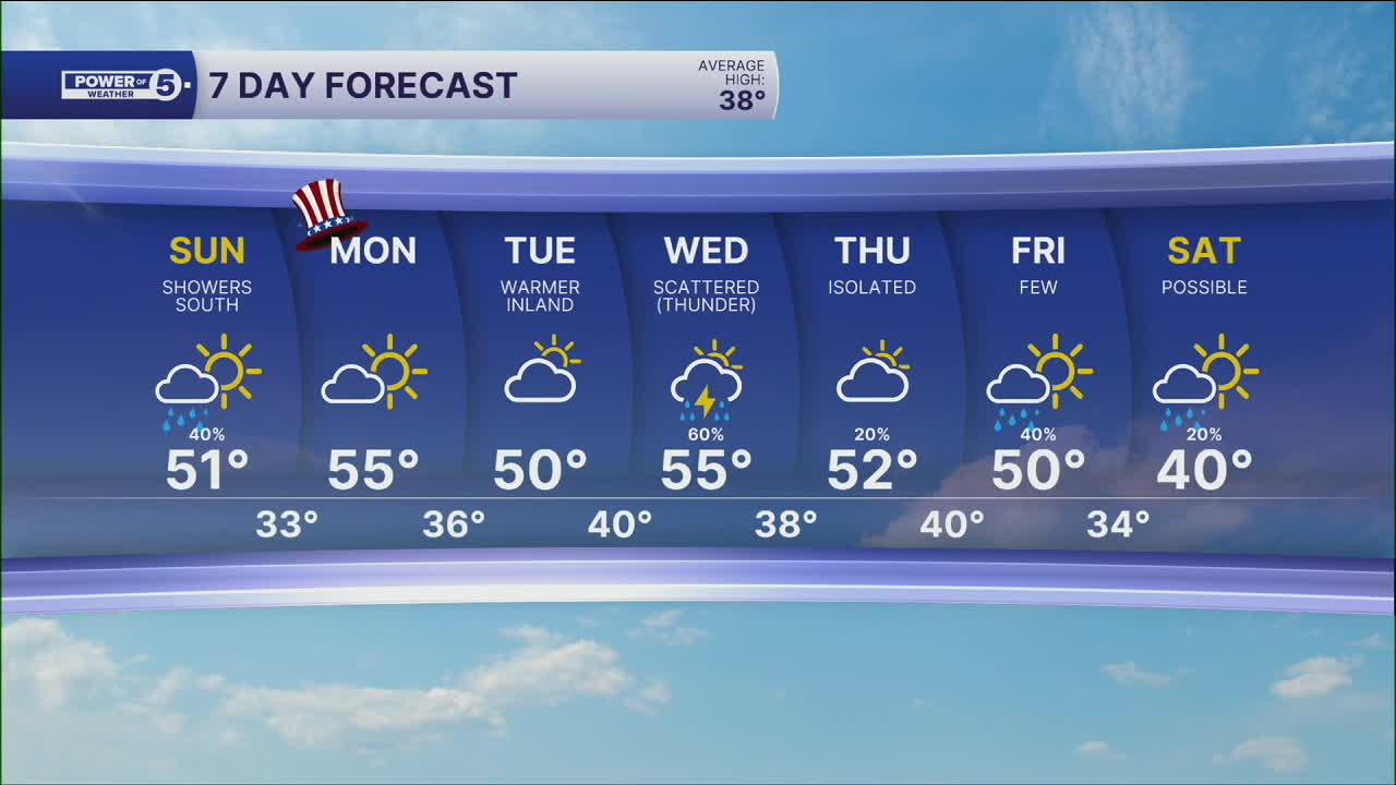
DAILY FORECAST:
Sunday: Warmer. Rain chances south. | High: 51º
President's Day: AM Fog. Warmer. Partly Sunny. | High: 55º
Tuesday: Lake breeze could cool us down. | High: 50º
Wednesday: Rain chances return. Thunder? Warm front lifts north. | High: 55º
Thursday: Rain possible. Chilly. | High: 52º
Want the latest Power of 5 weather team updates wherever you go? Download the News 5 App free now: Apple|Android
Click here to view our interactive radar.
Follow the News 5 Weather Team:
Trent Magill: Facebook & Twitter
Katie McGraw: Facebook & Twitter
Phil Sakal: Facebook & Twitter
Allan Nosoff: Facebook & Twitter
