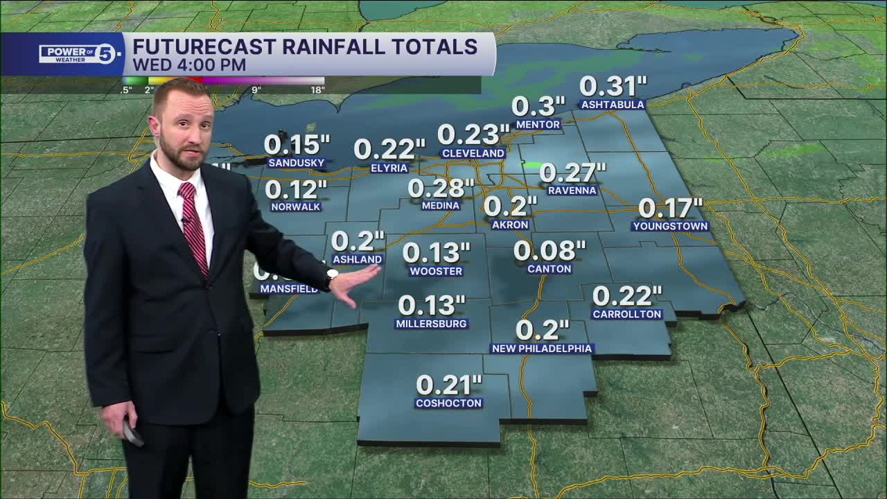


CLEVELAND — Rain will become more widespread ahead of a cold front by mid-morning on Wednesday, and will begin to taper off during the early afternoon. Isolated thunder will be possible during the morning on Wednesday. Rain totals of up to a quarter inch will be possible across the region from Tuesday night into the early afternoon on Wednesday.
Temperatures will be even warmer on Wednesday, with highs into the upper 50s and lower 60s! Another round of rain and thunder will begin to move in late Thursday through Friday, as another front moves through. Stronger storms will be possible with this second front Thursday evening into Thursday night. Something we will keep an eye on.
Enjoy this thaw, but don't forget, it's still February!
Colder air looks to arrive in time for the weekend, along with snow chances...
DAILY FORECAST:
Wednesday: Scattered rain with thunder possible, windy. | High: 62º
Thursday: Isolated rain possible. Cooler. | High: 55º
Friday: Scattered thunder, mild & breezy. | High: 57º
Saturday: Slim shot of Flakes. Colder. | High: 37º
Sunday: Snow Possible. Touch colder. | High: 35º
Monday: Few snow showers. Cold. | High: 29º
Want the latest Power of 5 weather team updates wherever you go? Download the News 5 App free now: Apple|Android
Click here to view our interactive radar.
Follow the News 5 Weather Team:
Trent Magill: Facebook & Twitter
Katie McGraw: Facebook & Twitter
Phil Sakal: Facebook & Twitter
Allan Nosoff: Facebook & Twitter
