


CLEVELAND — Temperatures CRASHED today as a strong cold front moved through NEO. Temps fell 40 degrees from Sunday to Monday. As temperatures fell, rain changed to snow showers. Widespread snow moved through this evening, with some communities picking up a quick 1-2 inches. Additional snow accumulation will be possible into tomorrow as lake effect snow sets up in time for St. Patrick's Day. When all is said and done, most communities will see 1 to 3 inches of snow, but for some, 4-6 inches will be possible, especially in the snowbelts.
If you are getting your green on for the St. Paddy's Day parade, plan to dress VERY warm! This will be the coldest St. Paddy's day in decades! Highs will not get out of the middle 20s on Tuesday. While it will not be as windy, breezy conditions will keep wind chills in the teens and single digits for most of the day! Snow will gradually come to an end by Tuesday evening.
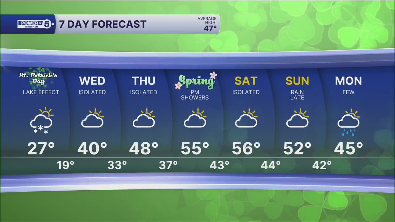
Any snow accumulation will not last long! Temperatures will jump above freezing by Wednesday, and above-average temperatures return by the end of the week! Plan for highs nearing 40 by Wednesday and 50s starting Thursday and continuing into the weekend!
DAILY FORECAST:
Monday Night: Breezy. Very cold. Snow showers. | Temps: Teens
St. Patrick's Day: Frigid with lake effect snow. Single-digit chills. | High: 27º
Wednesday: Isolated rain/snow showers. Warmer. | High: 38º
Thursday: Isolated shower. Seasonable temps. | High: 50º
Friday: More clouds. Few showers late. Touch warmer. | High: 55º
Saturday: Mostly cloudy. Chilly. | High: 54º
Want the latest Power of 5 weather team updates wherever you go? Download the News 5 App free now: Apple|Android
Click here to view our interactive radar.
Follow the News 5 Weather Team:
Trent Magill: Facebook & Twitter
Katie McGraw: Facebook & Twitter
Phil Sakal: Facebook & Twitter
Allan Nosoff: Facebook & Twitter
