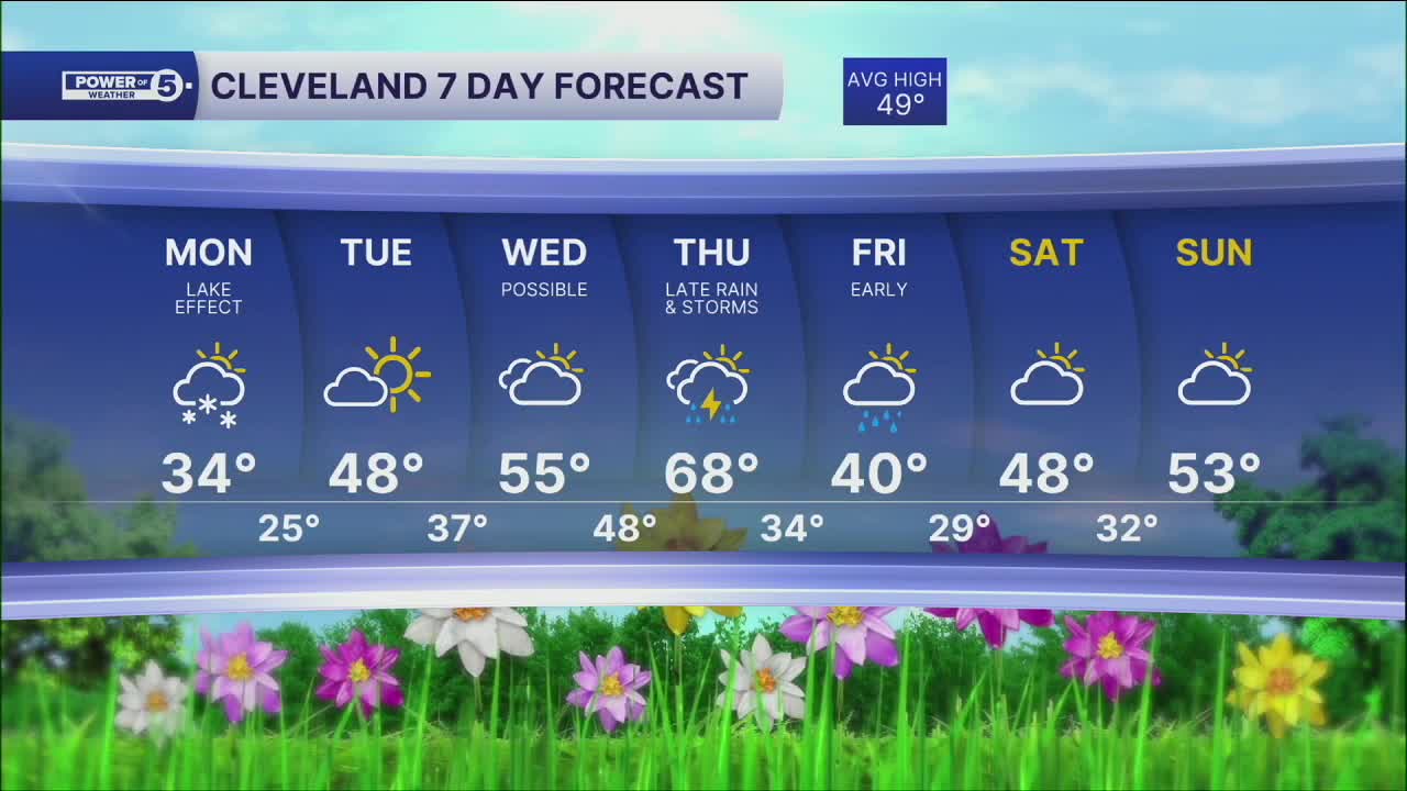


CLEVELAND — Expect another temperature drop on Monday, and a chance for lake effect snow showers for the morning commute. Even coatings on colder surfaces can't be ruled out through midday as some of the snow showers could pack a brief punch. It's a one hit wonder of cold as warmer air returns midweek.
Temperatures will return to more seasonable levels on Tuesday with highs in the upper 40s to around 50, along with more sunshine.
The sun will be short lived, as more clouds move in for the middle of the week, but it will get warmer again. Highs will top off in the mid to upper 50s on Wednesday, and nearing 70 by Thursday.
Rain and storm chances will return late Thursday into early Friday. Colder air will once again return to round out the week into next weekend.
DAILY FORECAST:
Monday: Mostly cloudy. Snow showers to flurries. Colder. | High: 34º
Tuesday: More sunshine. Seasonable. | High: 48º
Wednesday: Mostly cloudy. Warmer. | High: 55º
Thursday: Rain/Storms Late. Warmer. | High: 68º
Friday: Early showers. Colder again. | High: 40º
Saturday: Mostly cloudy. Warmer. | High: 48º
Sunday: Mostly cloudy. Touch Warmer. | High: 53º
Want the latest Power of 5 weather team updates wherever you go? Download the News 5 App free now: Apple|Android
Click here to view our interactive radar.
Follow the News 5 Weather Team:
Trent Magill: Facebook & Twitter
Katie McGraw: Facebook & Twitter
Phil Sakal: Facebook & Twitter
Allan Nosoff: Facebook & Twitter
