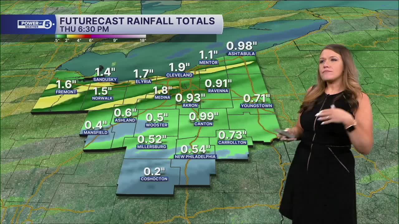


CLEVELAND — Strong winds over 50 mph with widespread rain that could be heavy at times are likely for all of NEO overnight and into Thursday morning. After 8 pm through the wee hours of Thursday morning, strong storms are possible.
We will continue to monitor the radar for stronger or severe storms, including damaging winds and heavy rain. It is important to note that the rain and wind will be impactful no matter what.
Widespread rain will exit early on Thursday. It will remain gusty on Thursday, though. Winds will gradually decrease throughout the course of the day. A few showers will be possible on Thursday afternoon, and we will be cooler, as highs will only be in the lower 70s, and no threat for severe weather.
Thankfully, we will see calmer conditions return for Friday and Saturday, but a couple t-showers cannot be ruled out. A much better chance for rain and storms looks possible for Father's Day, so keep this in mind if you have outdoor plans with dad!
DAILY FORECAST:
Wednesday Night: Wet and windy.| Low: 64º
Thursday: Few Showers. Cooler & breezy.| High: 73º
Juneteenth: Partly sunny and seasonable.| High: 77º
Saturday: Partly sunny. Mainly dry.| High: 77º
Want the latest Power of 5 weather team updates wherever you go? Download the News 5 App free now: Apple|Android
Click here to view our interactive radar.
Follow the News 5 Weather Team:
Trent Magill: Facebook & Twitter
Katie McGraw: Facebook & Twitter
Phil Sakal: Facebook & Twitter
Allan Nosoff: Facebook & Twitter
