


CLEVELAND — A cold front is moving through Ohio on Saturday morning, bringing an end to the 50-degree warmth for most. It might briefly get back to 50 degrees south of Route 30, but everyone will cool down quick this afternoon and evening. Following right behind the cold front is yet another clipper, and this one will bring more snow to Ohio this evening and overnight.
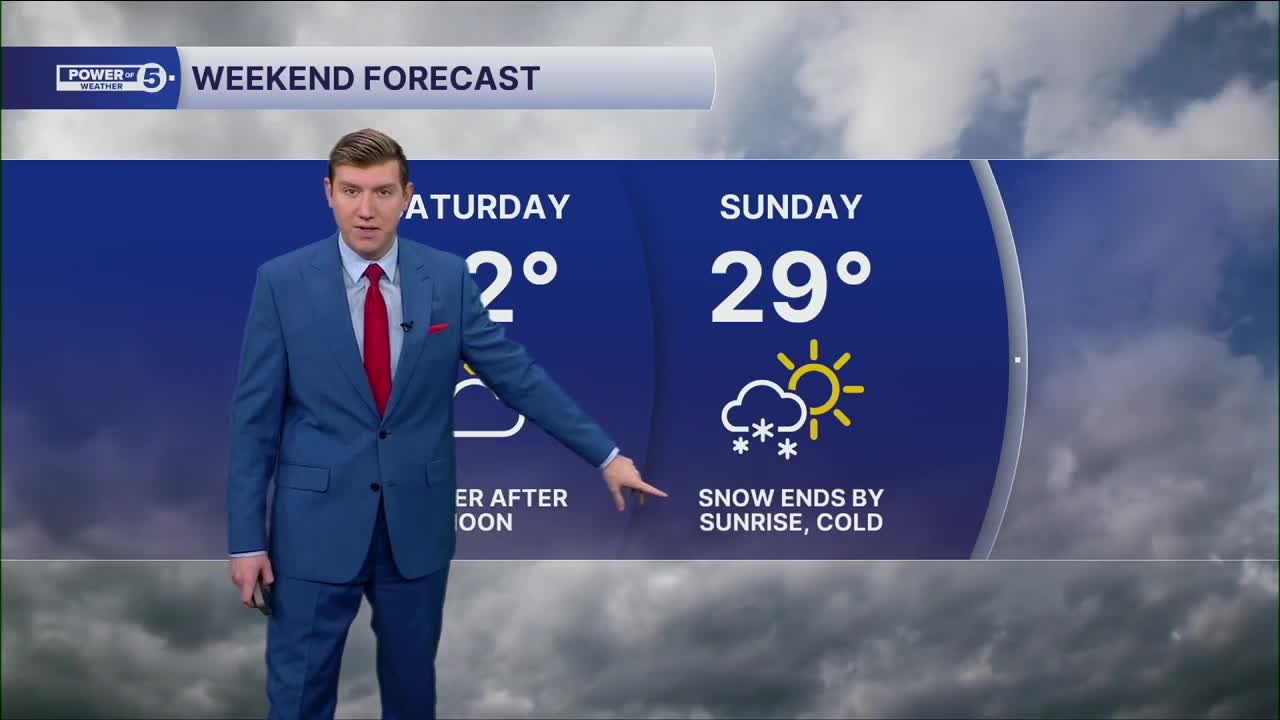
A few snow showers are possible around sunset at the lakefront. Snow overspreads most of the area after 10 p.m. with a quick inch or two possible, mainly in the primary snowbelt. Most of the snow will melt with above-freezing temps south of Akron. Everyone gets below freezing by Sunday morning, and temps struggle even to reach 30 during the day.
The next storm on Monday will stay south and chilly but dry conditions are expected. Tuesday's storm is now expected to be stronger and warmer, meaning a faster transition from mix/ice to rain. This storm will then be the start of a major pattern change. Spring might finally be here for more than just a day or two by the end of the week! Records by the end of next workweek are in the 70s, so while not out of reach, it is too soon to know if they will be in jeopardy. Stay tuned for updates on that.
DAILY FORECAST:
Saturday: More clouds. Isolated snow possible late along the lakeshore. | High: 48º (and falling)
Sunday: Much colder with a slim shot at snow early. | High: 29º
Monday: More clouds and cold. | High: 35º
Tuesday: Scattered ice/rain mix to rain. | High: 45º
Wednesday: Warming up with showers possible. | High: 52º
Thursday: Better shot at rain and possible t-storms. | High: 63º
Want the latest Power of 5 weather team updates wherever you go? Download the News 5 App free now: Apple|Android
Click here to view our interactive radar.
Follow the News 5 Weather Team:
Trent Magill: Facebook & Twitter
Katie McGraw: Facebook & Twitter
Phil Sakal: Facebook & Twitter
Allan Nosoff: Facebook & Twitter
