


CLEVELAND — A strengthening storm is expected to stay south of the area Sunday morning, with rain likely for the Columbus and Cincinnati metros, not Cleveland. It will bring even warmer weather behind it, with increasing sun on Sunday afternoon. Highs reach the 50s for more of the area, with everyone in the 50s on Monday.
With the snow melt, increasing humidity levels, along with temperatures falling back into the lower 30s over the next couple of mornings, freezing fog could be possible, especially on Monday morning.
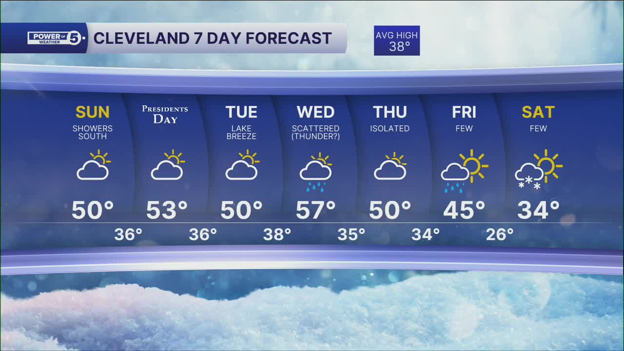
Temperatures will be well above average through most of the work week, with our next best shot at rain and even a few storms, holding off until Wednesday.
With this warmth and the rain, the threat of ice jams is real. All of this moisture in our snowpack has to go somewhere. When the rivers get swollen and the ice breaks free, those jams can be a BIG concern.
DAILY FORECAST:
Sunday: Warmer. Rain chances south. | High: 50º
President's Day: AM Fog. Warmer. Partly Sunny. | High: 53º
Tuesday: Lake breeze could cool us down. | High: 50º
Wednesday: Rain chances return. Thunder? Warm front lifts north. | High: 57º
Thursday: Rain possible. Chilly. | High: 47º
Want the latest Power of 5 weather team updates wherever you go? Download the News 5 App free now: Apple|Android
Click here to view our interactive radar.
Follow the News 5 Weather Team:
Trent Magill: Facebook & Twitter
Katie McGraw: Facebook & Twitter
Phil Sakal: Facebook & Twitter
Allan Nosoff: Facebook & Twitter
