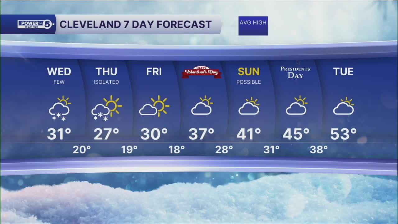


CLEVELAND — A few lake effect snow showers will be possible on Wednesday, mainly in the snowbelt. Light accumulations will be possible, with most under an inch. Slick spots will be possible on Wednesday, with the lake effect potential, but also the threat of black ice. Temperatures will be in the upper 20s to around 30 most of the day on Wednesday.
Sub-Freezing temperatures will linger into Thursday and Friday, along with isolated lake effect snow shower chances on Thursday.
Warmer air begins to make a comeback this weekend into next week, with highs in the 40s by Sunday, and perhaps above 32° overnight lows by Monday night.
DAILY FORECAST:
Wednesday: Mostly cloudy with a few lake effect snow showers. | High: 31º
Thursday: Isolated lake effect snow. | High: 27º
Friday: Looking dry but chilly. | High: 30º
St. Valentine's Day: Dry & seasonable. | High: 37º
Sunday: Warmer. Looking Dry. | High: 41º
President's Day: Warmer. Partly Sunny. | High: 45º
Tuesday: Warmer Again. | High: 53º
Want the latest Power of 5 weather team updates wherever you go? Download the News 5 App free now: Apple|Android
Click here to view our interactive radar.
Follow the News 5 Weather Team:
Trent Magill: Facebook & Twitter
Katie McGraw: Facebook & Twitter
Phil Sakal: Facebook & Twitter
Allan Nosoff: Facebook & Twitter
