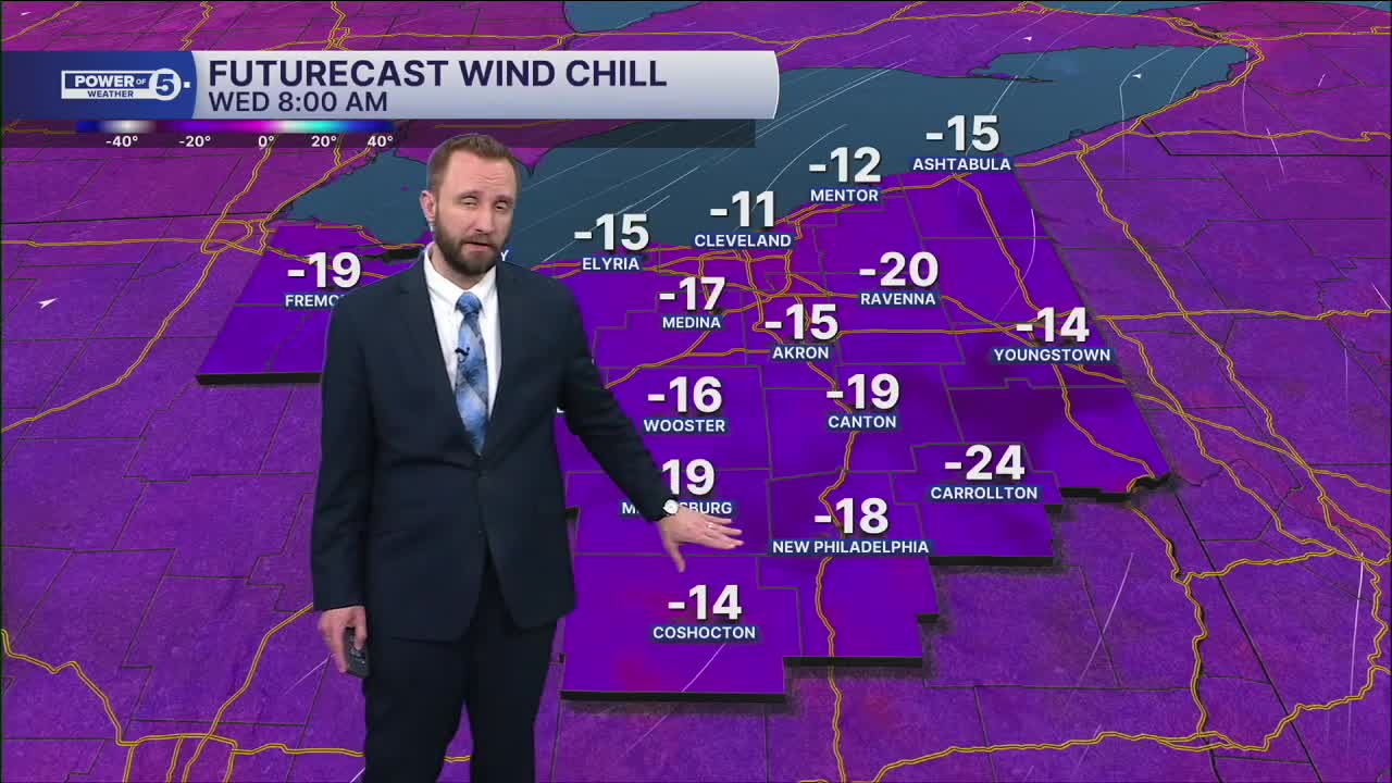


CLEVELAND — A Cold Weather Advisory in effect until 11 AM Wednesday, with Wind Chills from -15 to -24°
The nights will be near advisory criteria all week. Nighttime lows near 0º. Afternoons in the teens. You can go ahead and subtract 10-15º for the wind chills. That's the story all week.
We may even drop colder toward Friday into Saturday morning. You're going to hear a lot about the Polar Vortex weakening and allowing arctic air to spill south and into Ohio.
That also means snowfall for some. Lake Erie is over 90 percent covered, but there's still a LOT of open water. That means lake effect snow is still possible.
DAILY FORECAST:
Wednesday: Isolated snow chances, staying frigid. | High: 1º
Thursday: Isolated snow possible & frigid | High: 14º
Friday: Isolated snow showers possible, cold. | High: 8º
Saturday: Isolated snow showers possible, cold. | High: 12º
Sunday: Isolated snow showers possible, cold. | High: 15º
Monday: Few snow showers possible, cold. | High: 22º
Tuesday: Isolated snow showers possible, cold. | High: 22º
Want the latest Power of 5 weather team updates wherever you go? Download the News 5 App free now: Apple|Android
Click here to view our interactive radar.
Follow the News 5 Weather Team:
Trent Magill: Facebook & Twitter
Katie McGraw: Facebook & Twitter
Phil Sakal: Facebook & Twitter
Allan Nosoff: Facebook & Twitter
