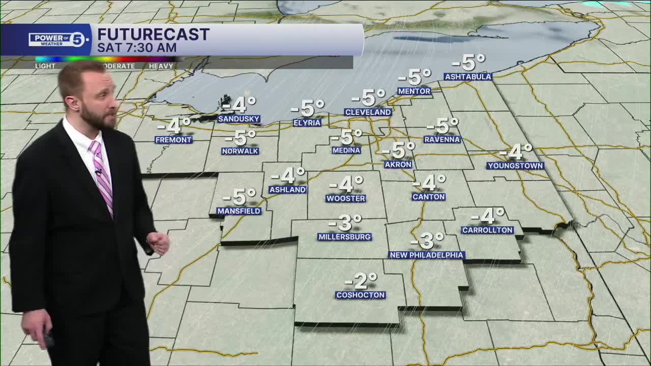


CLEVELAND — Air temperatures will be BELOW zero on Saturday morning, with sub-zero wind chills again. Temperatures will only "warm" into the single digits again Saturday afternoon. If we stay in the single digits on Saturday, then that'll be the coldest day since 2019!
All of that before our first BIG snow storm of the year. Moving into Ohio by late Saturday into Sunday.
Here's a look at the timeline:
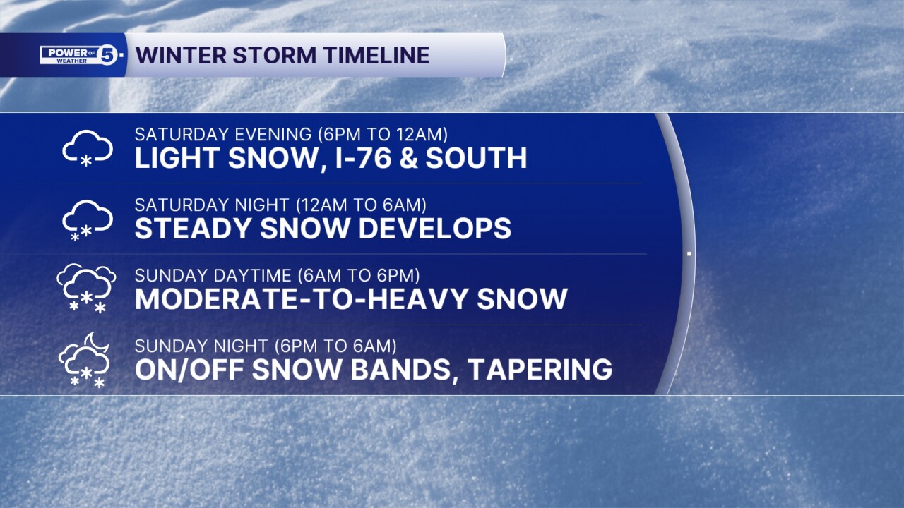
Steady snow will be during the daylight hours on Sunday, with the heaviest during the late morning into the afternoon on Sunday. Snow rates will be a couple of inches an hour across the state.
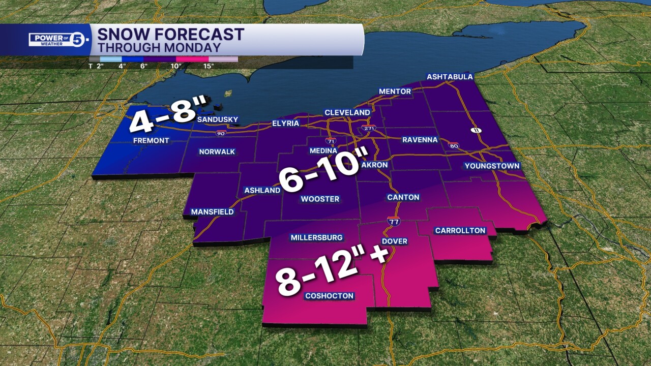
Totals will be higher in our southeastern communities, but certainly substantial for all of Northeast Ohio, as most will see over 6 inches to nearly a foot from Saturday evening through Monday morning.
Temperatures will remain well below freezing for days and days to wrap up January and to start February.
Stay Warm and Safe, Northeast Ohio!
DAILY FORECAST:
Saturday: Brutal cold. Sub-Zero Chills. Snow Late. | High: 8º
Sunday: Winter Storm looking more likely with heavy snow and wind. | High: 18º
Monday: Lake Effect Snow Showers Possible. Frigid. | High: 13º
Tuesday: Partly Sunny. Few flakes possible. Still Frigid. | High: 16º
Wednesday: Isolated flakes possible. Still Frigid. | High: 15º
Thursday: Flakes possible. Still Frigid. | High: 16º
Friday: Partly Sunny. Still Frigid. | High: 13º
Want the latest Power of 5 weather team updates wherever you go? Download the News 5 App free now: Apple|Android
Click here to view our interactive radar.
Follow the News 5 Weather Team:
Trent Magill: Facebook & Twitter
Katie McGraw: Facebook & Twitter
Phil Sakal: Facebook & Twitter
Allan Nosoff: Facebook & Twitter
