


CLEVELAND — Several rounds of on-again, off-again snow showers have moved through Northern Ohio Monday afternoon and evening, and one more round is expected through at least midnight, likely through 3 a.m. on the east side, earlier west.
The clouds will linger after this round of snow departs. That means temps won't drop nearly as low as they have been. Still cold, but holding near 20º rather than 0º... that is much warmer than the last week-plus at night!
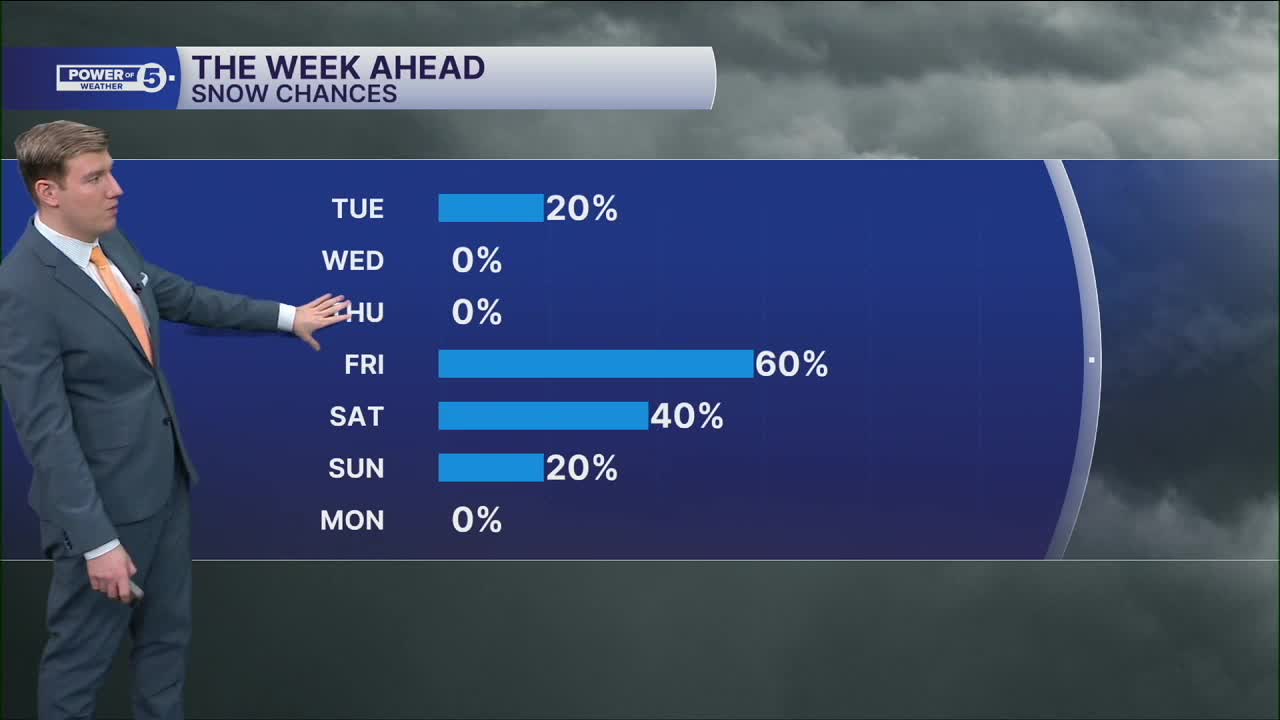
Shovelable snow returns Tuesday south of the I-70 corridor. Southern Ohio has a mess on its hands tomorrow. We in Northeast Ohio only have an isolated lake effect burst here or there, and maybe one band of light snow from that other storm reaches Coshocton County. It's a light northwest breeze, but enough that we can't rule it out. Minor accums also, with an additional trace to an inch.
There is a better shot at shovelable snow in the area on Friday. Depending on the exact track and intensity, a few inches are possible. It's also our next best shot to touch 32º... The first time in 14 days!
DAILY FORECAST:
Tuesday: Isolated snow showers possible with a snow squall or two late. | High: 25º
Wednesday: Isolated morning snow shower, otherwise mostly cloudy. | High: 20º
Thursday: Sun & clouds, cold. | High: 22º
Friday: Scattered snow showers. | High: 31º
Saturday: Lake effect snow possible. | High: 10º
Want the latest Power of 5 weather team updates wherever you go? Download the News 5 App free now: Apple|Android
Click here to view our interactive radar.
Follow the News 5 Weather Team:
Trent Magill: Facebook & Twitter
Katie McGraw: Facebook & Twitter
Phil Sakal: Facebook & Twitter
Allan Nosoff: Facebook & Twitter
