


CLEVELAND — Factor in the snowpack melting, and our already swollen rivers... Ice jams and flooding are major threats to Northeast Ohio rivers. We're watching the river levels closely. Make sure you're signed up for local mobile alerts if you live in any flood-prone areas, especially with the concern of warmer temperatures and rain in the forecast.
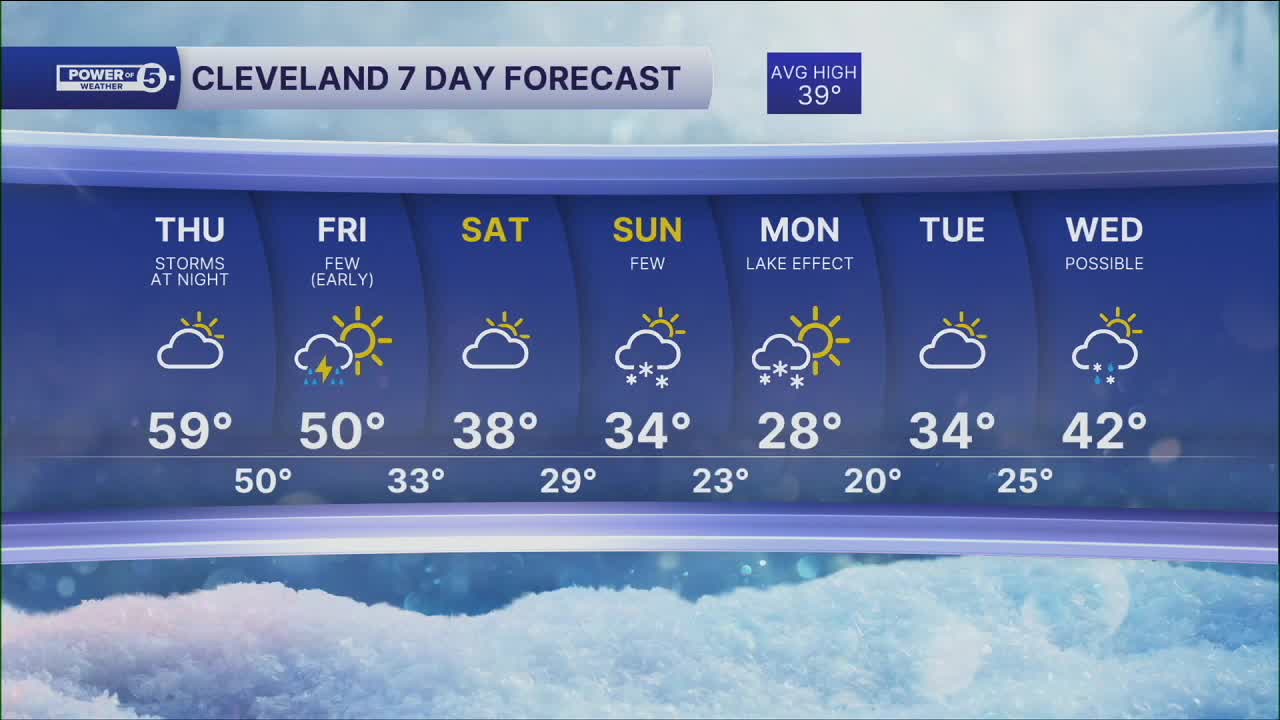
Temperatures will remain well above average with highs into the upper 50s and lower 60s on Thursday.
Another round of rain and thunder will begin to move in late Thursday and continue into early Friday as another front moves through. Stronger storms will be possible with this second front Thursday evening into Thursday night. Something we will keep an eye on. Most of the rain should be gone by early Friday morning.
Enjoy this thaw, but don't forget, it's still February!
Temperatures on Friday will begin on the warmer side, with many locations in the upper 40s to around 50, but will be falling back into the 30s by lunch time through the afternoon. A few rain/snow showers will be possible by Friday afternoon
Colder air looks to linger for the weekend, along with an increase of snow showers by Sunday.
DAILY FORECAST:
Thursday: PM Isolated rain possible. More rain is likely late. | High: 59º
Friday: Early rain. Few PM rain/snow showers. Breezy & falling temperatures. | High: 50º
Saturday: Slim shot of Flakes. Colder. | High: 38º
Sunday: Snow Possible. Touch colder. | High: 34º
Monday: Few snow showers. Cold. | High: 28º
Want the latest Power of 5 weather team updates wherever you go? Download the News 5 App free now: Apple|Android
Click here to view our interactive radar.
Follow the News 5 Weather Team:
Trent Magill: Facebook & Twitter
Katie McGraw: Facebook & Twitter
Phil Sakal: Facebook & Twitter
Allan Nosoff: Facebook & Twitter
