


CLEVELAND — Hello Spring!!
Spring starts Friday morning, at 10:46 to be exact. It's the Spring Equinox. That means the planet is tilted perfectly TOWARD the sun. Our days are getting longer!
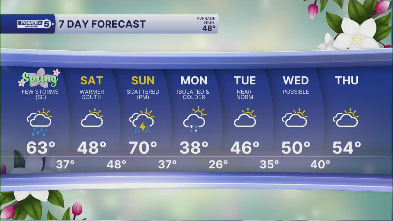
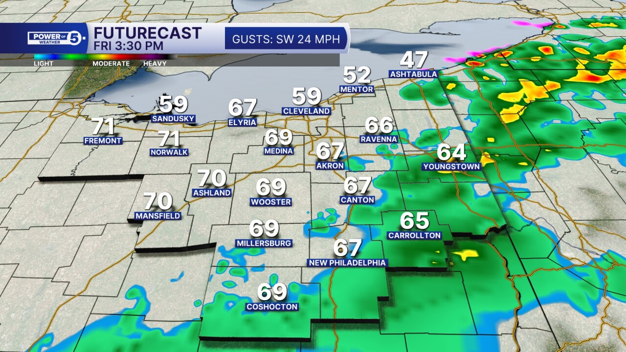
And Friday is going to feel like spring! Temperatures should be in the 60s for everyone, but there is another storm system on the way, including another warm front with a trailing cold front. This means we need to plan for more ups and downs. Friday will be windy and warmer, with most of us in the 60s. That's warm enough for scattered rain with embedded thunderstorms.
The best chance for storms is during the afternoon and evening, and in our southeastern communities. A rogue strong or severe storm is possible, but storms do not look to last for long. Most of Friday night plans will be rain-free.
We're dry again on Saturday, but temperatures will drop again, thanks to that trailing cold front. Highs could get stuck in the 40s, especially closer to the lake. And then we are right back up on Sunday!
A new system will bring another windy, warm, and unsettled day with strong storms possible on Sunday, before... (can you guess) another temperature drop on Monday.
DAILY FORECAST:
Thursday night: Chilly, mostly cloudy, and dry. | Low: 39º
Friday: Still mostly cloudy but warmer with a few showers & storms. | High: 62º
Saturday: Mostly cloudy, cool. Warmer (50s) inland. | High: 48º
Sunday: Windy, warmer, more storms late. Could be strong. | High: 70-º
Monday: Mostly cloudy. Isolated flakes. Colder. | High: 38º
Tuesday: More sunshine. Seasonable. | High: 46º
Wednesday: Mostly cloudy. | High: 54º
Want the latest Power of 5 weather team updates wherever you go? Download the News 5 App free now: Apple|Android
Click here to view our interactive radar.
Follow the News 5 Weather Team:
Trent Magill: Facebook & Twitter
Katie McGraw: Facebook & Twitter
Phil Sakal: Facebook & Twitter
Allan Nosoff: Facebook & Twitter
