


CLEVELAND — Brrrr... It was officially one of the coldest St. Patrick's Days in decades! The high in Cleveland only reached 25 degrees! It remains frigid tonight with lows in the teens and low 20s. It will continue to feel even colder by early Wednesday morning thanks to breezy southerly winds at 10-15 mph.
Scattered snow showers will finally come to an end by tonight, though! Any snow accumulation will not last long!
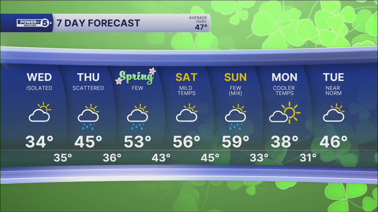
Temperatures are on the rise! Plan for mid to upper 30s by Wednesday, seasonable temperatures in the 40s on Thursday, and above-average temperatures return by the end of the week! 50s are likely on Friday and continuing into the weekend!
Wednesday will be mostly dry, but rain is looking more likely for Thursday afternoon and evening. So grab your umbrellas!
DAILY FORECAST:
Tonight: Frigid. Snow ending. | Low: 21º
Wednesday: Isolated rain/snow showers. Not as frigid. | High: 35º
Thursday: Seasonable but rainy. | High: 45º
Friday: Still mostly cloudy but warmer with isolated showers possible. | High: 53º
Saturday: Mostly cloudy, milder. | High: 58º
Want the latest Power of 5 weather team updates wherever you go? Download the News 5 App free now: Apple|Android
Click here to view our interactive radar.
Follow the News 5 Weather Team:
Trent Magill: Facebook & Twitter
Katie McGraw: Facebook & Twitter
Phil Sakal: Facebook & Twitter
Allan Nosoff: Facebook & Twitter
