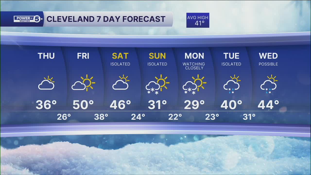


CLEVELAND — We stay dry the rest of the work week. Chilly Thursday with highs in the 30s, but we rebound again on Friday. Highs topping off in the low to even mid 50s, under mostly sunny skies, a great Friday is on tap.
The weekend is going to see another cool down, as temperatures will fall back into the 40s by Saturday and 30s on Sunday.
We're keeping a close eye on late Sunday into the start of the new work week for another round of winter weather, with snow possible for parts of Northeast Ohio. Stay Tuned!
DAILY FORECAST:
Thursday: Cold again. Partly cloudy. | High: 36º
Friday: More sunshine, warmer and breezy. | High: 50º
Saturday: More clouds. Isolated snow possible. | High: 46º
Sunday: Colder. More snow possible. | High: 31º
Monday: Snow Possible. Watching Closely. | High: 29º
Tuesday: Isolated Rain/Snow Possible. Watching Closely. | High: 40º
Want the latest Power of 5 weather team updates wherever you go? Download the News 5 App free now: Apple|Android
Click here to view our interactive radar.
Follow the News 5 Weather Team:
Trent Magill: Facebook & Twitter
Katie McGraw: Facebook & Twitter
Phil Sakal: Facebook & Twitter
Allan Nosoff: Facebook & Twitter
