


CLEVELAND — Many Ohioans, especially in the snowbelt, woke up to a fresh coating of snow, mainly on grass and untreated surfaces. A couple of spots in the primary snowbelt received up to 2 inches. A couple of unusual NE/SW lake-effect bands have set up this morning, which can drop an additional coating to an inch through midday.
Everywhere else, the big deal is the cold. Mother Nature did not get the new month memo. Today's weather is essentially a continuation of the cold February weather the area has dealt with. Highs will struggle to reach the upper 20s. With a 15-25 mph breeze, it will feel like the teens.
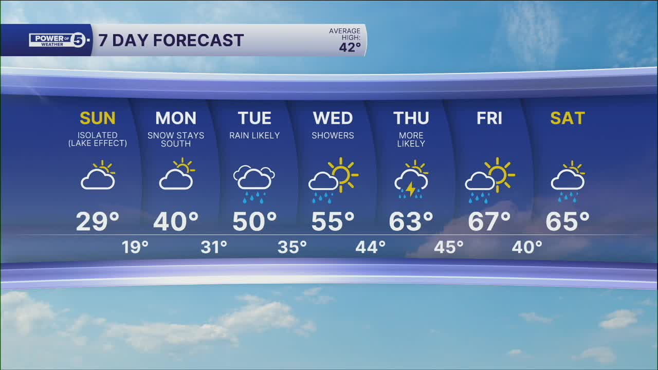
The next storm on Monday will stay south, and chilly but dry conditions are expected. With some bonus sunshine, highs can get close to 40 degrees, which is still a couple of degrees below average. Tuesday's storm is now expected to be stronger and warmer, meaning a faster transition from mix/ice to rain. Aside from a brief burst of wintry mix in the higher elevations on the east side, this should be all rain for the Tuesday morning commute.
This storm will then be the start of a major pattern change. Spring might finally be here for more than just a day or two by the end of the week! Records by the end of next workweek are in the 70s, so while not out of reach, it is too soon to know if they will be in jeopardy. Stay tuned for updates on that.
DAILY FORECAST:
Sunday: Much colder with a slim shot at snow early. | High: 29º
Monday: More clouds and cold. | High: 40º
Tuesday: Scattered ice/rain mix to rain. | High: 50º
Wednesday: Warming up with showers possible. | High: 55º
Thursday: Better shot at rain and possible t-storms. | High: 63º
Thursday: Showers possible. 70s inland. | High: 67º
Want the latest Power of 5 weather team updates wherever you go? Download the News 5 App free now: Apple|Android
Click here to view our interactive radar.
Follow the News 5 Weather Team:
Trent Magill: Facebook & Twitter
Katie McGraw: Facebook & Twitter
Phil Sakal: Facebook & Twitter
Allan Nosoff: Facebook & Twitter
