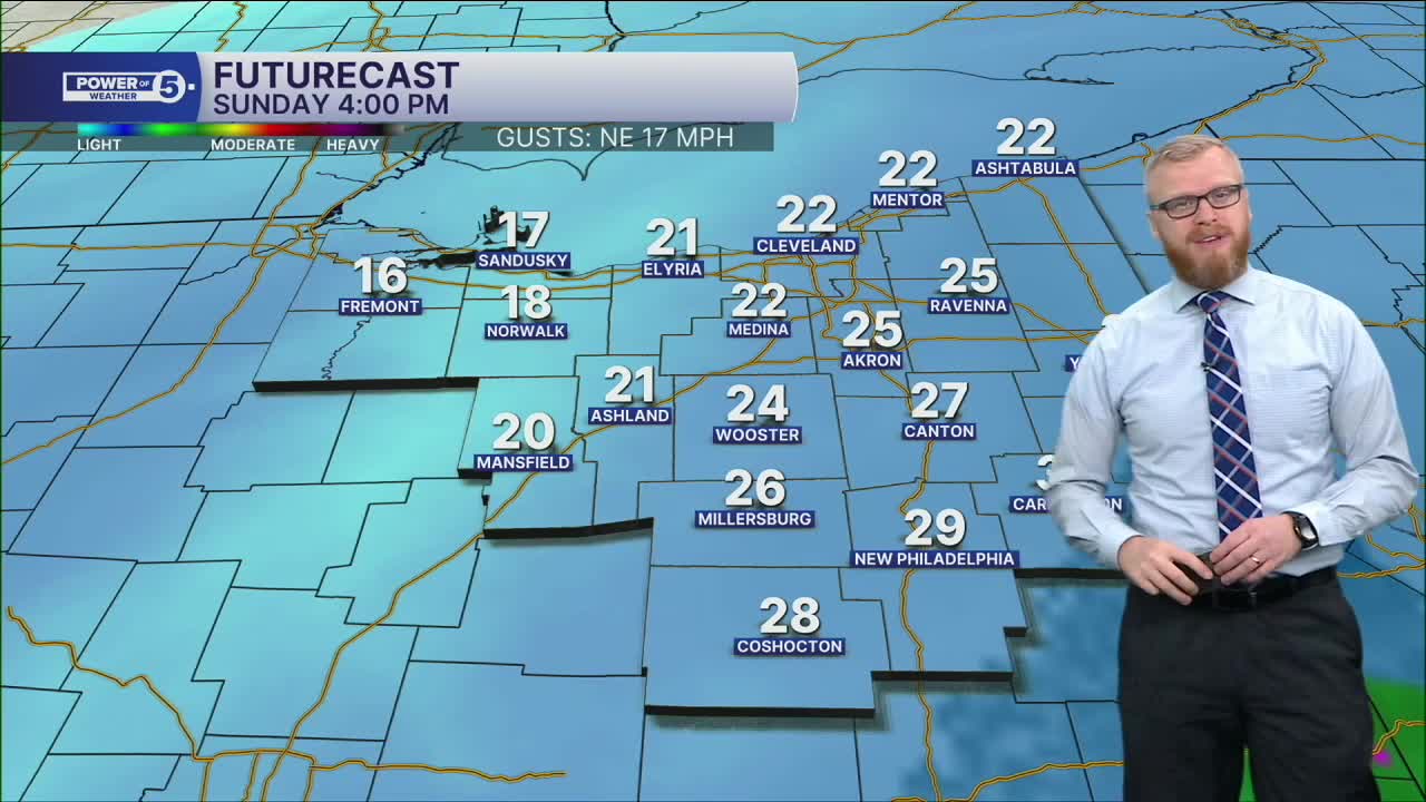


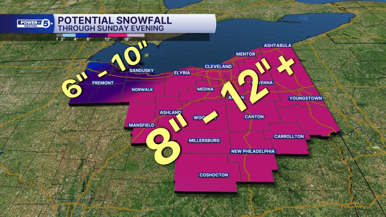
CLEVELAND — The storm is here. It started snowing around midnight last night. It won't stop snowing until just after sunset this evening. That means about 18hours of snowfall. That'll eventually add up to nearly 1' of snow. It's been a LONG time since Cleveland has had 12" of snowfall in under 24 hours. About 30 years. We've had storms that have dropped more than a foot but over more than 1 day. I'm saying there's a chance.
Snowfall rates today will be under 1"/hour for the overwhelming majority. There are a few waves that peak at 1"/hr, though. The reason I'm pointing that rate out is because that's when visibility drops and roads suffer quickly. The message all day stays the same: "Avoid roads if you don't need to be on them."
Temperatures will remain well below freezing for days and days to wrap up January and to start February. That is a stretch of two weeks or more.
Stay Warm and Safe, Northeast Ohio!
DAILY FORECAST:
Sunday: Tracking light/moderate snow with a few heavy bursts. | High: 23º
Monday: Lake Effect Snow Showers Possible. Frigid. | High: 16º
Tuesday: Partly Sunny. Few flakes possible. Still Frigid. | High: 14º
Wednesday: Snow possible late. Still Frigid. | High: 15º
Thursday: Snow possible transitioning to lake effect. Still Frigid. | High: 13º
Friday: Partly Sunny. Still Frigid. | High: 8º
Want the latest Power of 5 weather team updates wherever you go? Download the News 5 App free now: Apple|Android
Click here to view our interactive radar.
Follow the News 5 Weather Team:
Trent Magill: Facebook & Twitter
Katie McGraw: Facebook & Twitter
Phil Sakal: Facebook & Twitter
Allan Nosoff: Facebook & Twitter
