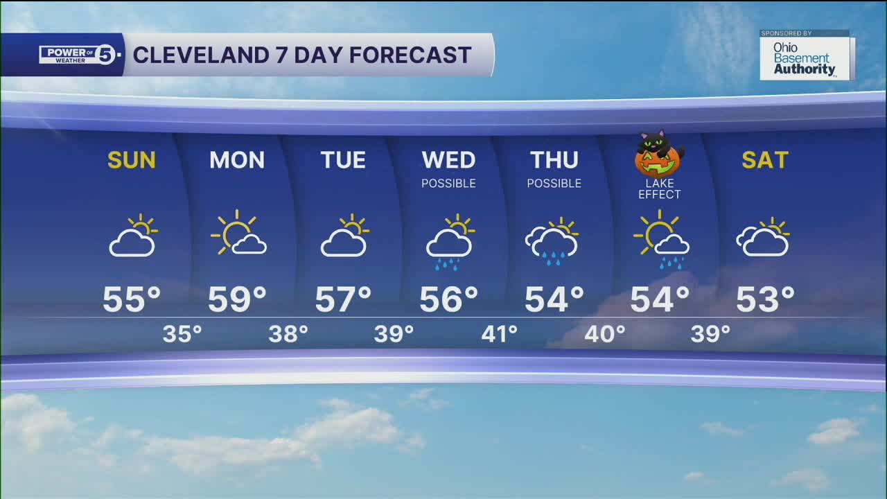


CLEVELAND — A stray lake effect rain shower will be possible early on Sunday; otherwise, we'll see a dry second half of the weekend across Northeast Ohio. Temperatures will struggle again, with partly sunny skies across the region. Highs will top off in the mid-to-upper 50s on Sunday afternoon.
More sunshine is expected to begin the work week, with highs back into the mid-to-upper 50s on Monday. Clouds will begin to increase by the middle of the week, along with rain chances.
The next system we are watching is a doozy! It will be diving south from the northern plains to the Tennessee River valley midweek, then combine with a coastal storm into one, larger 'frankenstorm' by Thursday. The exact track and intensity will be key to how much rain works its way into our area. Showers are possible as early as Wednesday as this system approaches, but it is not a guarantee. We will be sure to keep you posted on the latest trends and potential lake-effect precipitation after the storm on Halloween, so be sure to check back or tune in.
DAILY FORECAST:
Sunday: Stray AM Lake Effect. Partly Sunny. Cool. | High: 55º
Monday: Mostly sunny, pick of the week. | High: 59º
Tuesday: More clouds, still dry. | High: 57º
Wednesday: Rain possible. More clouds. | High: 56º
Thursday: Rain possible. Watching closely. | High: 54º
Halloween: Lake Effect Showers possible. Cool. | High: 54º
Saturday: Drier. Partly sunny. Cool. | High: 53º
Want the latest Power of 5 weather team updates wherever you go? Download the News 5 App free now: Apple|Android
Click here to view our interactive radar.
Follow the News 5 Weather Team:
Trent Magill: Facebook & Twitter
Katie McGraw: Facebook & Twitter
Phil Sakal: Facebook & Twitter
Allan Nosoff: Facebook & Twitter
