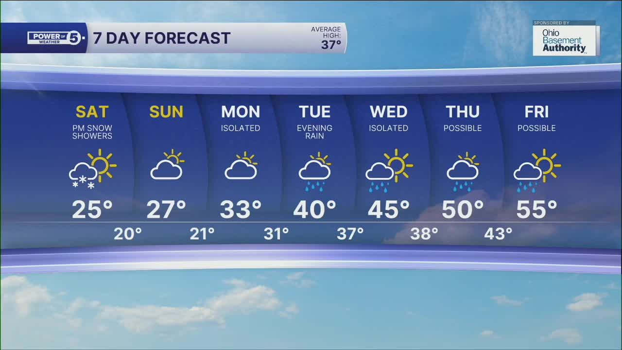


CLEVELAND — Lake effect snow has tapered off, for now. Some more snow showers are on the way later Saturday and Saturday night, albeit on the lighter side. It will also remain frigid both Saturday and Sunday. A much-needed thaw is on its way...next week. We'll have to get through a few more rounds of light snow moving through the area before we see a change in precipitation type.
A quick burst of light-to-steady snow is possible Saturday evening and night, mainly along the lakeshore. A coating to an inch, especially with some lake enhancement, is possible in the snowbelt. Sunday itself will be dry, and cold like mentioned. Another snow shower or two is possible late Sunday night into early Monday morning, but it should not be much of an impact.
The 40s arrive on Tuesday after a transition day out of the cold and stormy pattern. 40s to near 50 by the middle of next week?! It's possible! 50 is currently our forecast high on Thursday, but it comes with rain, as do most warm-ups this time of year. 50s are also possible on Friday.
DAILY FORECAST:
Today: More clouds and cold. Few PM/Evening snow showers. | High: 26º
Sunday: Mostly cloudy. Cold. | High: 27º
Monday: A few light AM now showers. | High: 33º
Tuesday: Cloudy but milder with a slim rain chance. | High: 40º
Wednesday: Showers possible. Milder. | High: 45º
Thursday: Rain possible. Warmer. | High: 50º
Want the latest Power of 5 weather team updates wherever you go? Download the News 5 App free now: Apple|Android
Click here to view our interactive radar.
Follow the News 5 Weather Team:
Trent Magill: Facebook & Twitter
Katie McGraw: Facebook & Twitter
Phil Sakal: Facebook & Twitter
Allan Nosoff: Facebook & Twitter
