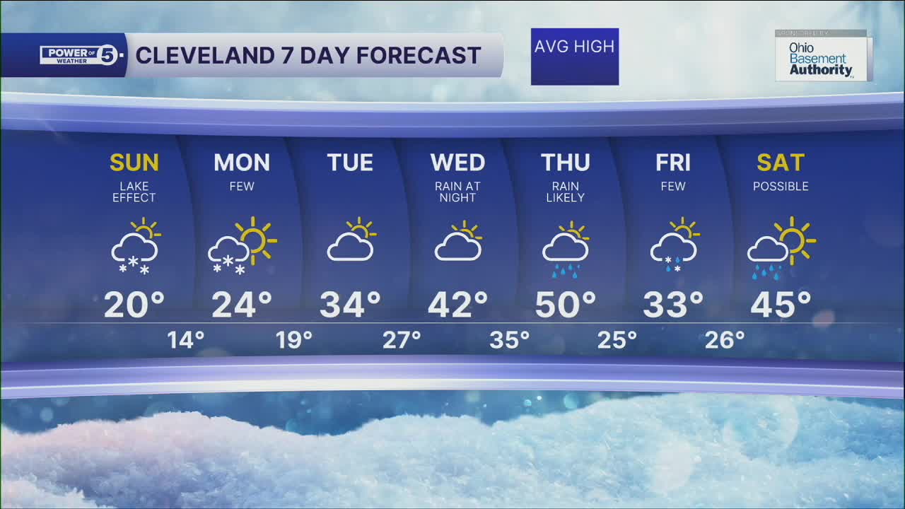


CLEVELAND — Frigid air and heavy lake effect snow showers will be in place for your Sunday! Temperatures will begin in the lower Teens and Single Digits, along with well below zero wind chills. Lake effect snow will ramp up during the morning on Sunday. 1/2" to 1" an hour snowfall will be possible, especially where *squalls persist* in the Snowbelt.
Lake Effect snow will linger through most of Sunday, but will begin to lessen its impact by Sunday night through Monday morning. The Cold will not through. We will not see 32° until sometime on Tuesday afternoon.
If you're looking for a thaw... be patient. It's finally showing up midweek next week. A massive area of high pressure will bring warmer weather to three-quarters of the country by the end of next week. We'll be on the northern edge, so the 40s will return by Thursday.
DAILY FORECAST:
Sunday: Lake effect snow. Colder. Below-zero wind chills. | High: 22º
Monday: Lake effect snow showers. Still cold. | High: 22º
Tuesday: Clouds and sun | High: 33º
Wednesday: Shower possible late. Warmer. | High: 42º
Thursday: Rain showers possible. Warm. | High: 49º
Want the latest Power of 5 weather team updates wherever you go? Download the News 5 App free now: Apple|Android
Click here to view our interactive radar.
Follow the News 5 Weather Team:
Trent Magill: Facebook & Twitter
Katie McGraw: Facebook & Twitter
Phil Sakal: Facebook & Twitter
Allan Nosoff: Facebook & Twitter
