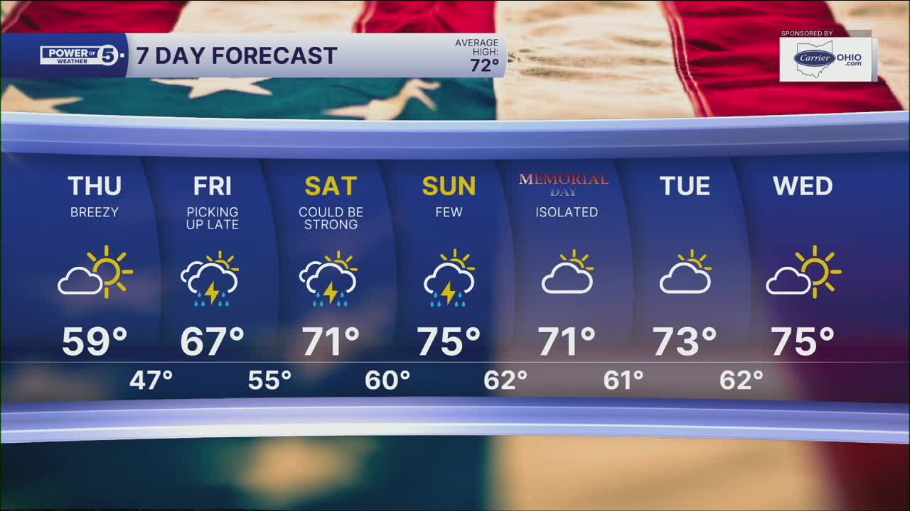


CLEVELAND — We started the day in the 60s but quickly dropped into the 50s. It was about a 15º drop in 15 minutes! Make sure you pack an extra layer, and you'll need it again on Thursday. It will be much drier on Thursday, but still in the 50s and low sixties.
Showers are gradually pulling away from NEO this evening, but it will remain cloudy and chilly overnight with temperatures in the 40s early on Thursday. As mentioned above, it will stay chilly tomorrow, but it will get brighter throughout the day. It will also be breezy thanks to a northeasterly wind of 10 to 20 mph.
The holiday weekend looks active. For any Memorial Day cookouts or memorial services, have a backup plan to get inside if Mother Nature tries to attend.
Rain will be returning from the south on Friday afternoon, becoming widespread by Friday evening. At this time, Saturday looks soaked with heavy rain and storms. Additional storms are expected on Sunday, but there should be a lot more dry time in comparison to Saturday. The best day of the holiday weekend looks to happen on Memorial Day. It should be seasonal with only isolated showers.
DAILY FORECAST:
Tonight: Drying out and chilly.| Low: 45º
Thursday: Still cool, breezy but brighter. | High: 59º
Friday: A bit milder with t-storms returning by the evening. | High: 66º
Saturday: Soaked. Rain could be heavy at times. | High: 71º
Sunday: Few T-showers | High: 70º
Want the latest Power of 5 weather team updates wherever you go? Download the News 5 App free now: Apple|Android
Click here to view our interactive radar.
Follow the News 5 Weather Team:
Trent Magill: Facebook & Twitter
Katie McGraw: Facebook & Twitter
Phil Sakal: Facebook & Twitter
Allan Nosoff: Facebook & Twitter
