


CLEVELAND — It was an active week with much-needed rain across NEO. The southern half of our viewing area picked up 2-3 inches of rain over the last week. The rainfall amounts were lower along the lakeshore, where 0.5 to 1 inch of rain was much more common. This rainfall certainly helped to make a *small* improvement in the ongoing drought across the Buckeye State.
However, that is coming to a halt, and we will likely take a few steps back this week, thanks to another large high-pressure system building in from the west. This means that we have seen our last drops of rain for the next several days (perhaps a week or more!). In fact, the trend for below-average precipitation could continue until early October.
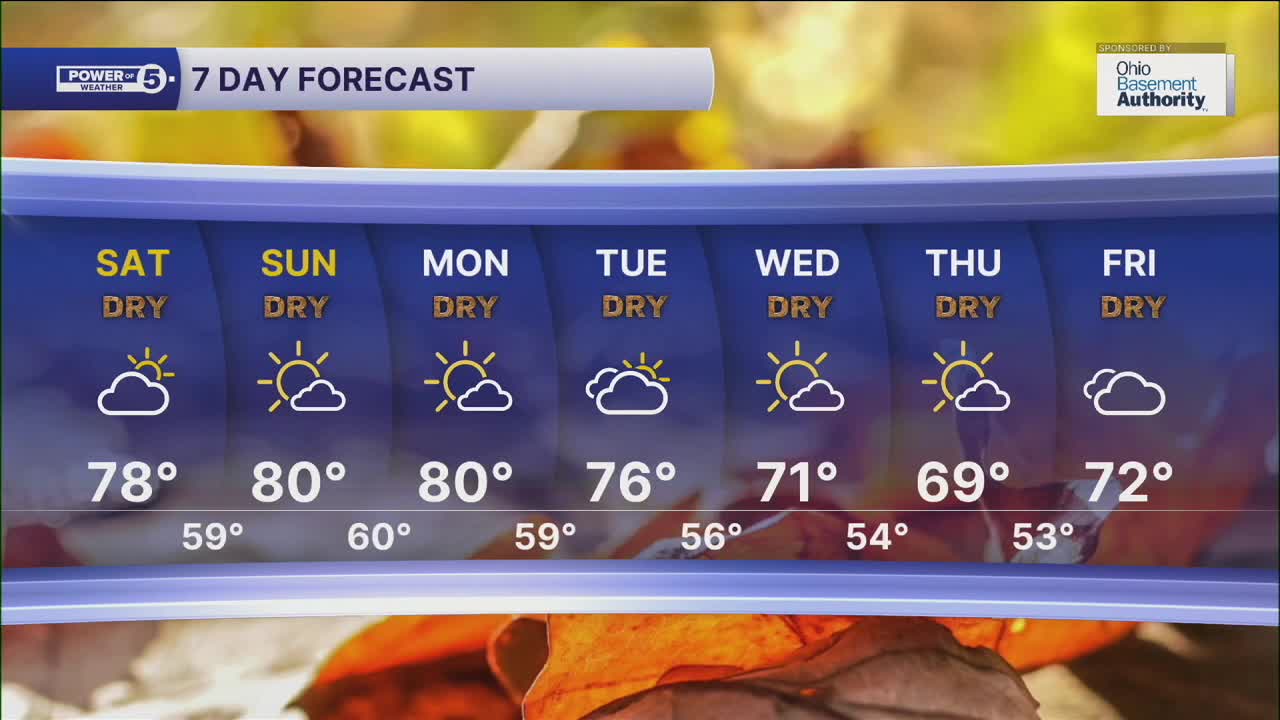
Not only is the dry weather returning, but we are heating up as well! Upper 70s to low 80s are possible on Saturday, and it could be a couple degrees warmer than that on Sunday and Monday. Cooler temperatures will try to move in by the middle and end of next week as Canadian high pressure builds into the region.
DAILY FORECAST:
Friday Night: Mostly clear and cool. Areas of fog.| Low: 57º
Saturday: Dry, sunny, and warm.| High: 78º
Sunday: Even warmer! | High: 80º
Monday: August-like start to workweek. | High: 80º
Tuesday: Still dry, slightly cooler. | High: 76º
Want the latest Power of 5 weather team updates wherever you go? Download the News 5 App free now: Apple|Android
Click here to view our interactive radar.
Follow the News 5 Weather Team:
Trent Magill: Facebook & Twitter
Katie McGraw: Facebook & Twitter
Phil Sakal: Facebook & Twitter
Allan Nosoff: Facebook & Twitter
