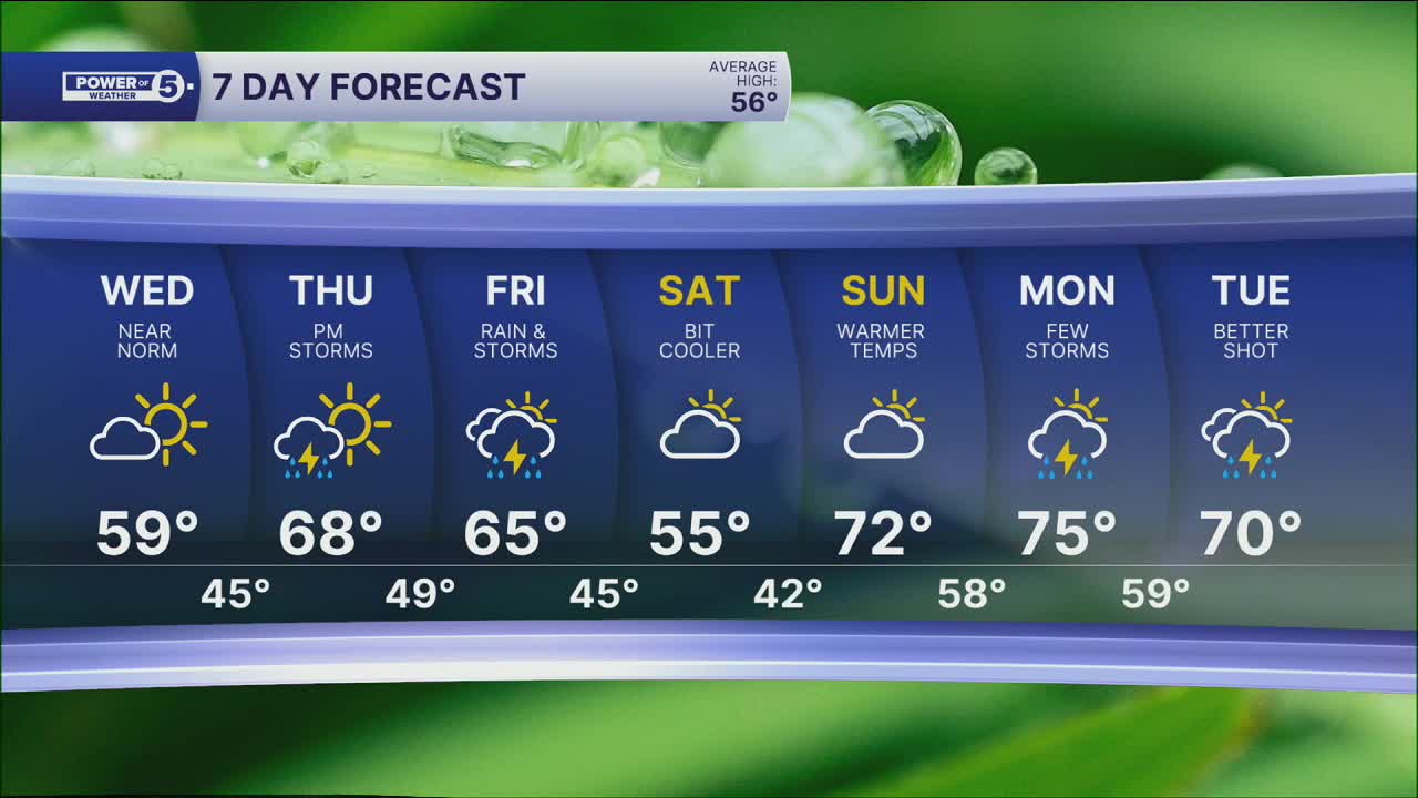


CLEVELAND — Brr! Temperatures have dropped like a rock over the last few days. Tuesday was a wintry day with temperatures in the 30s and even some flakes! While the sun came out to play, it was deceiving! It will remain quiet and cold tonight.
Cold start to Wednesday, but temps jump quickly. Plan on low to mid 20s out the door tomorrow morning, followed by ALMOST 60º by the afternoon! That's thanks to a wind shift... south winds helping us recover to near average temperatures.
Temperatures will bump up even more by the week's end, as highs will be well into the 60s to near 70 on Thursday. Rain returns Thursday afternoon and evening with more rain and storms on Friday.
Temperatures will drop a little bit by Saturday, but not as dramatic a change as we have grown used to over the last few weeks. This weekend looks mainly dry as well before more storms return by early next week.
DAILY FORECAST:
Tonight: Mostly clear & cold.| Low: 25°
Wednesday: Mostly sunny and seasonable.| High: 59°
Thursday: Warmer with a few t-showers late in the day.| High: 69º
Friday: Warm & breezy with scattered rain & storms.| High: 65°
Saturday: Cooler. Mainly dry.| High: 53°
Sunday: Warmer again.| High: 71°
Want the latest Power of 5 weather team updates wherever you go? Download the News 5 App free now: Apple|Android
Click here to view our interactive radar.
Follow the News 5 Weather Team:
Trent Magill: Facebook & Twitter
Katie McGraw: Facebook & Twitter
Phil Sakal: Facebook & Twitter
Allan Nosoff: Facebook & Twitter
