


CLEVELAND — Here comes the rebound! A brief but impressive warm-up is in the forecast for the next few days, but there will also be a chance of a few showers and even some storms this weekend.
Winds are finally relaxing across NEO, and that will continue tonight and into Friday. It will be mostly clear to partly cloudy overnight with chilly temperatures. Plan for a cold start to your Friday with temperatures in the mid to low 30s only! However, we will all rebound nicely by the afternoon. Plan for afternoon temperatures in the mid-50s!
It will be gorgeous, with less wind and more warmth. The temperature roller coaster reaches the top of the hill on Saturday, with widespread 60s on the way. However, as temperatures increase, so do the winds again and rain chances. It does not look like a washout, but a few afternoon and evening t-storms are expected on Saturday. This is most likely in our southern and eastern communities.
These storms are not expected to be severe, but some pockets of heavy rain and gusty winds are possible with the strongest storms, the highest chance being Saturday evening.
Storms fade quickly, but isolated showers will linger into Sunday morning, especially in our easternmost communities. The high temperature is expected to happen early on Sunday with a quick drop into the 40s. The temperatures will eventually drop into the 30s overnight into Monday. Next week is looking chilly and below average, with highs only in the 40s most days.
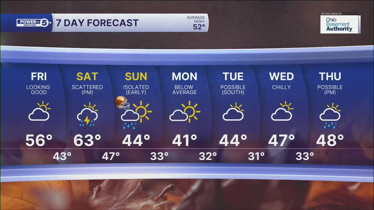
DAILY FORECAST:
Thursday Night: Variable clouds and chilly. | Low: 34º
Friday: Seasonable sunshine. | High: 54º
Saturday: Warm & breezy with afternoon storms.| High: 63º
Sunday: Showers early but drying & cool after. | High: 45º
Monday: Drying out but staying cool. | High: 41º
Want the latest Power of 5 weather team updates wherever you go? Download the News 5 App free now: Apple|Android
Click here to view our interactive radar.
Follow the News 5 Weather Team:
Trent Magill: Facebook & Twitter
Katie McGraw: Facebook & Twitter
Phil Sakal: Facebook & Twitter
Allan Nosoff: Facebook & Twitter
