

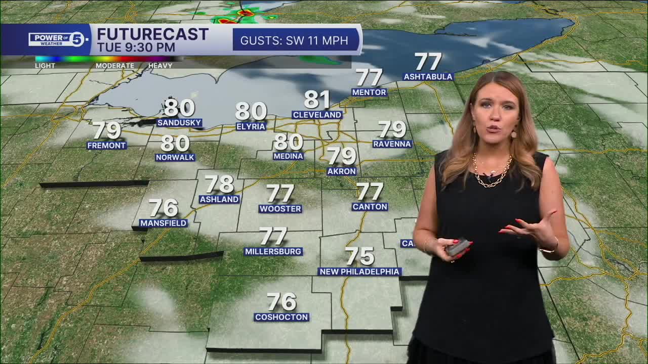


CLEVELAND — It's going to feel much more like the middle of summer than early September. Heat advisories are in effect through Wednesday evening as temps climb to around 90 degrees.
Unfortunately, there won't even be much relief tonight. Temps only fall into the mid-70s overnight, keeping homes feeling warm and sticky through Wednesday morning. With tropical-level humidity in place, the heat index will exceed 100 degrees on Wednesday in several communities across NEO.
Not only is it going to be steamy, but it will be stormy too. Some storms could become strong or severe. Storms will start isolated and become more likely across more of our regions on Thursday and Friday. Cooler, drier air finally settles in for the holiday weekend.
Power of 5 Regions highlight: Snowbelt Region:
Rounds of showers and storms are expected over the next few days. Exact placement and timing of storms is tricky to predict, but there is a potential for a cluster of storms to roll through Wednesday morning and bring the greatest impacts to the Snowbelt Region, including Lake, Ashtabula, and Geauga Counties.
We will be watching for heavy rain that slows the morning commute, damaging winds, and hail. These storms are expected after 5 am and will exit by 9 or 10 am. We will keep you posted on any changes, but be weather-aware not only tomorrow morning but through the rest of the work week, as additional waves of storms are expected.
Power of 5 Regions highlight: West Region:
The West Region will likely be one of the hottest spots in Northeast Ohio over the next couple of days.
A southwest breeze combined with the flatter terrain west of Cleveland will allow hotter air to move in more efficiently. Many communities could reach the lower 90s on Wednesday, with heat index values approaching or exceeding 100 degrees. If you have outdoor plans, take frequent breaks, drink plenty of water, and try to limit strenuous activity during the hottest part of the day.
Looking ahead:
It remains unsettled through the rest of the week. A cold front will move through NEO by the end of the week, with lingering storm chances on Thursday and Friday. The good news? A cooler air mass looks set to arrive for the holiday weekend along with a gradual drying trend. As of Monday evening, Labor Day is trending dry! We will keep you posted on the holiday weekend forecast.
5-Day Forecast
Tuesday: Hot and humid. Isolated PM storm. | High: 91º
Wednesday: Hot and humid. Storms possible. | High: 92º
Thursday: Scattered t-storms, flooding possible. | High: 86º
Friday: Scattered t-storms, still steamy. | High: 80º
Saturday: A few storms, much cooler | High: 78º
Learn the lingo: The Power of 5 Weather Team wants to get you your forecast closer to home. We have broken NEO into 5 separate and distinct regions. Find your region to get your hyper-local forecast!
- Cleveland Metro Region: Cuyahoga County. This region includes cities such as Cleveland, Parma, Westlake, Berea, Strongsville, Independence, Solon, Beachwood, and Euclid.
- Snowbelt Region: Lake, Geauga, and Ashtabula Counties. This includes cities such as Mentor, Geneva, Ashtabula, Bainbridge, Chardon, Burton, and Orwell.
- Akron-Canton Region: Summit, Stark, and Portage Counties. This region includes cities such as Akron, Canton, Hudson, Ravenna, Mantua, Alliance, and Canal Fulton.
- West Region: Lorain, Medina, Erie, Huron, Richland, and Ashland Counties. This region includes cities such as Lorain, Wellington, Medina, Lodi, Ashland, Mansfield, Willard, and Sandusky.
- South Region: Wayne, Holmes, Tuscarawas, Carroll Counties. This region includes Wooster, Millersburg, New Philadelphia, Strasburg, Mineral City, Carrollton, and Newcomerstown
Want the latest Power of 5 weather team updates wherever you go? Download the News 5 App free now: Apple|Android
Click here to view our interactive radar.
Follow the News 5 Weather Team:
Trent Magill: Facebook & Twitter
Katie McGraw: Facebook & Twitter
Phil Sakal: Facebook & Twitter
Allan Nosoff: Facebook & Twitter
