


CLEVELAND — A cold front is approaching from our north, and it has been producing thunderstorms in Canada and Michigan. As the front drifts south tonight, there is a SLIM shot we'll get in on one or two of those storms.
The best chance for any activity tonight will be in our western communities and before 2 am. You have a much better chance of staying dry all night and on Friday! Lows will be comfortable in the mid and low 60s with a few clouds overnight.
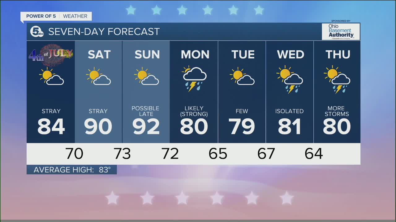
Most of the 4th of July holiday weekend looks great. High pressure is still dominating our air, so rain chances will be very small over the next few days, and anything that forms won't last long and shouldn't be damaging.
Temps are exactly what we'd expect for early July: middle 80s. That is, until we get into Saturday and Sunday. Big heat returns! Both Saturday and Sunday will be hot with highs in the low 90s and increasingly humid again. The increasing humidity will make it feel like the mid to even upper 90s.
Storms are possible late Sunday, especially in western Ohio, but as of now, it's looking like they won't be here until overnight into Monday. The highest chance for storms over the next week will fall on Monday. A few storms could become strong before cooler air pays us a visit on Tuesday.
DAILY FORECAST:
Thursday Night: Partly cloudy with a slim shot at rain.| Low: 65º
Independence Day: Beautiful sun and seasonable heat!| High: 84º
Saturday: Big heat and humidity.| High: 90º
Sunday: Another hot day with a few storms possible. | High: 92º
Monday: Storms are likely. Could be strong. | High: 80º
Tuesday: A Few storms. | High: 79º
Download the News 5 app for the latest weather updates:
Follow the News 5 Weather Team:
Trent Magill: Facebook & Twitter
Katie McGraw: Facebook & Twitter
Phil Sakal: Facebook & Twitter
