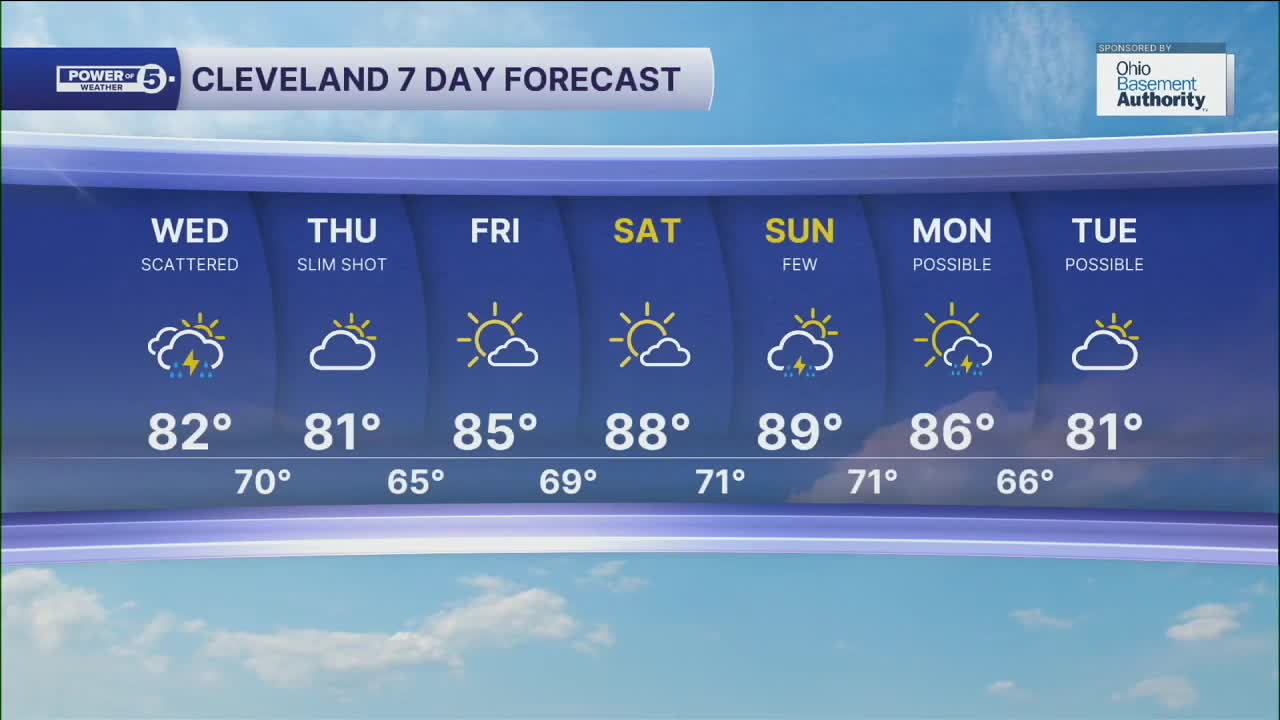


CLEVELAND — Wednesday will see more scattered showers and storms across NEO. Heavy rain, frequent lightning and isolated gusty winds will be possible. Temperatures will be cooler on Wednesday, as we'll top off in the low to mid 80s. Humidity will remain very tropical throughout Wednesday, but we will begin to see it lower by Thursday through Friday.
Heat will once again build back in for the weekend, as highs will approach 90 on Saturday and Sunday. Rain chances will return on Sunday, and may linger into the beginning of next week.
DAILY FORECAST:
Wednesday: Scattered storms. Humid. | High: 83º
Thursday: Drying out early with more seasonable temps. | High: 81º
Friday: Bright sun returning. | High: 85º
Saturday: Big heat returning. | High: 88º
Sunday: Hot & humid. | High: 89º
Want the latest Power of 5 weather team updates wherever you go? Download the News 5 App free now: Apple|Android
Click here to view our interactive radar.
Follow the News 5 Weather Team:
Trent Magill: Facebook & Twitter
Katie McGraw: Facebook & Twitter
Phil Sakal: Facebook & Twitter
Allan Nosoff: Facebook & Twitter
