


CLEVELAND — Storms will develop late this evening and early overnight, which will be after sunset for many.
A few storms may pop and be stronger, this will continue through 1am Sunday as it moves west to east. I expect downtown Cleveland and metro area between 10pm and 12am Sunday. The severe risk is low and I do not expect an outbreak. However, some areas of heavy rain and lightning possible, into early morning.
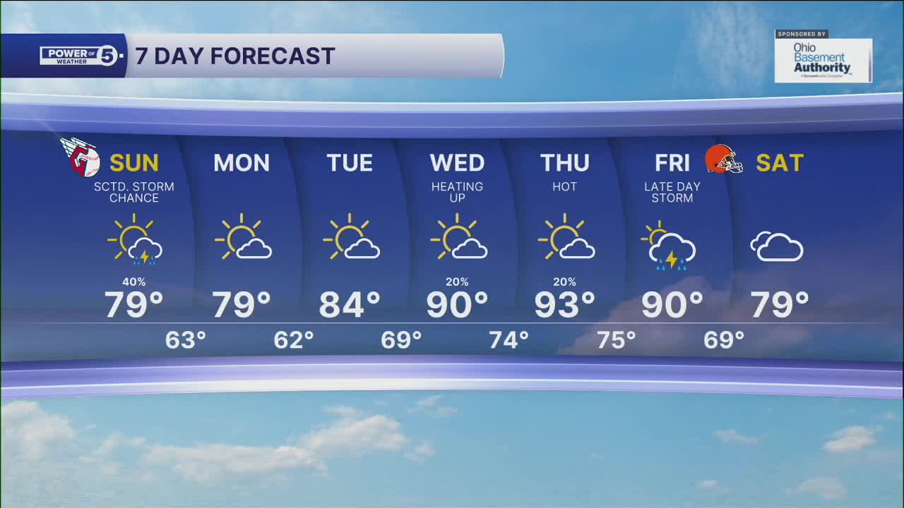
Most of us stay dry on Sunday, with just a slight chance early. The 90s will attempt a return next week with more hit-or-miss storms by the end of the week.
DAILY FORECAST:
Saturday Night: Storm chances until 2am. Severe risk low. | LOW: 72º
Sunday: A few t-storms, mainly south. | High: 79º
Monday: Looking dry and warm. | High: 80
Tuesday: Sunny and seasonal. | High: 84º
Download the News 5 app for the latest weather updates:
Follow the News 5 Weather Team:
Trent Magill: Facebook & Twitter
Katie McGraw: Facebook & Twitter
Phil Sakal: Facebook & Twitter
