


CLEVELAND — A warm, muggy, and dry evening continues into the overnight across NEO. Temperatures will only drop to around 70 for many late tonight, under mostly clear skies.
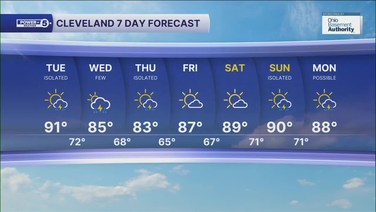
Another round of hot and humid weather in store for your Tuesday, but isolated storm chances will build in during the afternoon. Heavy rain will be possible if you are caught under one of these storms. Highs will top off around 90, with heat index values into the mid to upper 90s.
A weak boundary will bring the threat for more scattered showers and storms late Tuesday through Wednesday. More heavy rain will be possible, along with maybe a stronger wind gust or two. Temperatures will be slightly cooler, as highs will only be in the mid 80s for your mid-week.
Temps will drop back into the lower 80s on Thursday, with an isolated leftover storm chance. We'll also notice less humidity by Thursday, but it will not last long. More heat and humidity building back in for the weekend, along with the return of storm chances by Sunday.
DAILY FORECAST:
Tonight: Warm & muggy. Mostly clear. | Low: 70º
Tuesday: Hot and humid, Isolated storm. | High: 91º
Wednesday: More scattered storms possible. | High: 85º
Thursday: A bit cooler with isolated t'showers. | High: 83º
Friday: Drier and warming up again. | High: 87º
Saturday: Humid. Mostly sunny. | High: 89º
Want the latest Power of 5 weather team updates wherever you go? Download the News 5 App free now: Apple|Android
Click here to view our interactive radar.
Follow the News 5 Weather Team:
Trent Magill: Facebook & Twitter
Katie McGraw: Facebook & Twitter
Phil Sakal: Facebook & Twitter
Allan Nosoff: Facebook & Twitter
