


CLEVELAND — Monday was beautiful! Hopefully, you were able to enjoy it... storms return on Tuesday, with widespread, soaking rain by Tuesday evening & into Wednesday.
Spotty showers will remain possible tonight, but they will be very hit-or-miss with mild temperatures and breezy winds.
Out the door early on Tuesday will be mainly dry for a few hours. However, by the afternoon, storm chances increase. We will be watching for any stronger storms tomorrow afternoon, with heavy rain being the biggest threat. Temperatures will be falling from north to south throughout the day tomorrow.
That is especially true by Tuesday evening until Wednesday morning. When all is said and done, 0.50 to 1.5 inches of rain is expected across much of NEO. Widespread rain should end around lunchtime on Wednesday.
It will also be much cooler again. 50s return the rest of the week.
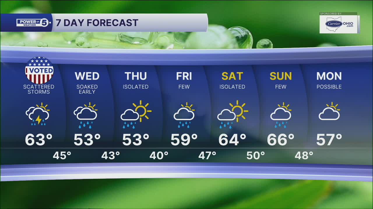
DAILY FORECAST:
Monday Night: Few t-showers overnight. Breezy | Low: 59º
Tuesday: Warm, windy & wet. Heavier rain later. | High: 64º
Wednesday: Soaked morning. Cooler. | High: 52º
Thursday: Mostly cloudy. Showers likely. Colder. | High: 51º
Friday: Mostly cloudy. Few showers possible. Not as chilly. | High: 54º
Saturday: Mostly cloudy. Showers possible. Warmer. | High: 59º
Want the latest Power of 5 weather team updates wherever you go? Download the News 5 App free now: Apple|Android
Click here to view our interactive radar.
Follow the News 5 Weather Team:
Trent Magill: Facebook & Twitter
Katie McGraw: Facebook & Twitter
Phil Sakal: Facebook & Twitter
Allan Nosoff: Facebook & Twitter
