


CLEVELAND — This round of snow will be wet and slushy, potentially causing fallen trees or branches, especially those near the lakeshore that still have a decent amount of leaves. The combination of the heavy wet snow and blustery winds with gusts over 30 miles per hour could lead to tree damage and even power outages.
Several inches of wet snow accumulation is looking likely, especially in the snowbelt Monday afternoon into Tuesday. Where squalls persist, especially in the first and secondary snow belts, there could be over a half a foot plus of snow Monday night into Tuesday morning. This will be all wind-dependent, as colder air moves over Lake Erie. Thundersnow will also be possible in stronger bands.
Roads will be slick while it's snowing, with the combination of wet leaves that are already slippery as-is. Make sure you're prepared for our first wintry day on Monday.
DAILY FORECAST:
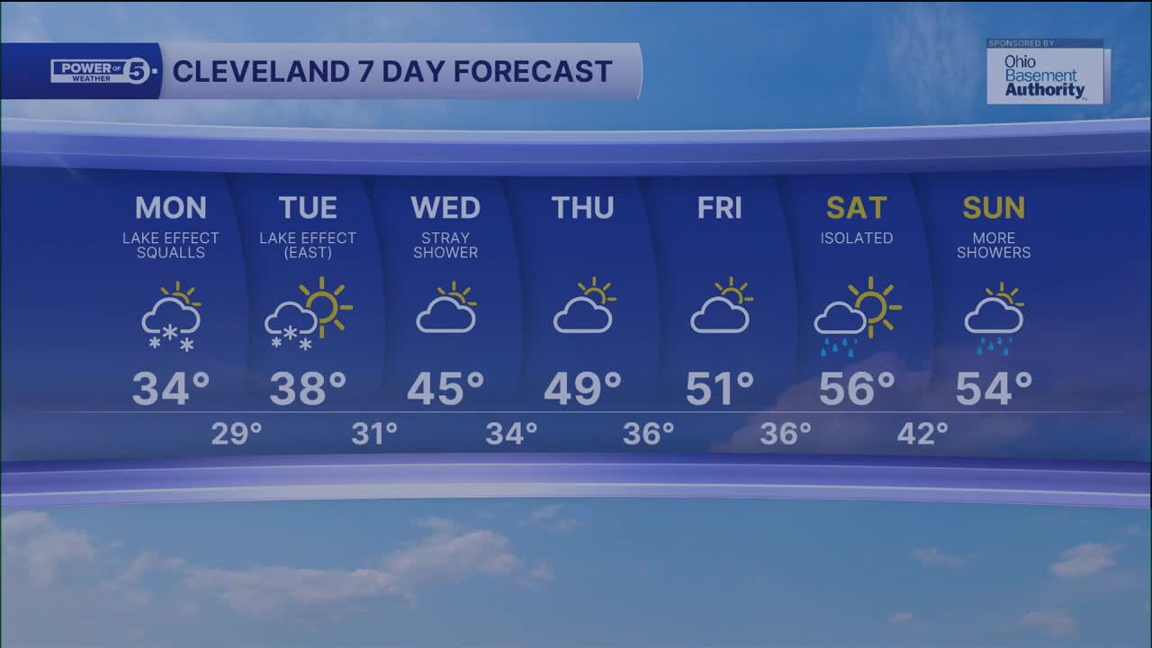
Monday: Lake effect snow squalls. Breezy & colder. | High: 34º (feels like 22-27º)
Tuesday: AM Lake effect snow on the east side. Not as cold. Breezy. | High: 38º (feels like 25-30º)
Wednesday: Stray leftover lake-effect shower. Partly sunny. Warmer. | High: 47º
Thursday: Dry. Partly sunny. | High: 49º
Friday: Partly sunny. Seasonable. | High: 50º
Saturday: Mostly cloudy. Warm. Chance of showers.| High: 56º
Want the latest Power of 5 weather team updates wherever you go? Download the News 5 App free now: Apple|Android
Click here to view our interactive radar.
Follow the News 5 Weather Team:
Trent Magill: Facebook & Twitter
Katie McGraw: Facebook & Twitter
Phil Sakal: Facebook & Twitter
Allan Nosoff: Facebook & Twitter
