



CLEVELAND —
Storm Chances this Evening into Monday
More storms will return, mainly impacting our West region first this evening. Storms will move in from western parts of Ohio between 9 and midnight. Damaging winds and heavy rain will be the biggest concerns. More storms will impact the area between 3 and 9 a.m., so plan to have umbrellas and windshield wipers for your commute. More heavy rain will be possible, along with gusty winds.
Power of 5 Region Spotlight: West Region
Any showers and/or storms will return to our West Region first tonight. As soon as about 9 or 10 p.m. lakeside, there can be a passing downpour or two. The main overnight round arrives after midnight, with the heaviest downpours for early commuters Monday morning.
Looking Ahead: Timing a trio of storms
There will be three rounds of storms Monday, impacting different regions at different times with potential damaging impacts.
Round 1: 3 to 9 am, drenching downpours (all regions), isolated severe
Round 2: 4 to 7 pm, pop-up strong-to-severe storms, primarily south of I-80
Round 3: after 10 pm, severe storms with damaging wind and isolated tornado threat. The later this round arrives, the less severe the threat will be. Root for the later timing, and make sure you have a way to get weather alerts, like turning on notifications on the News 5 app.
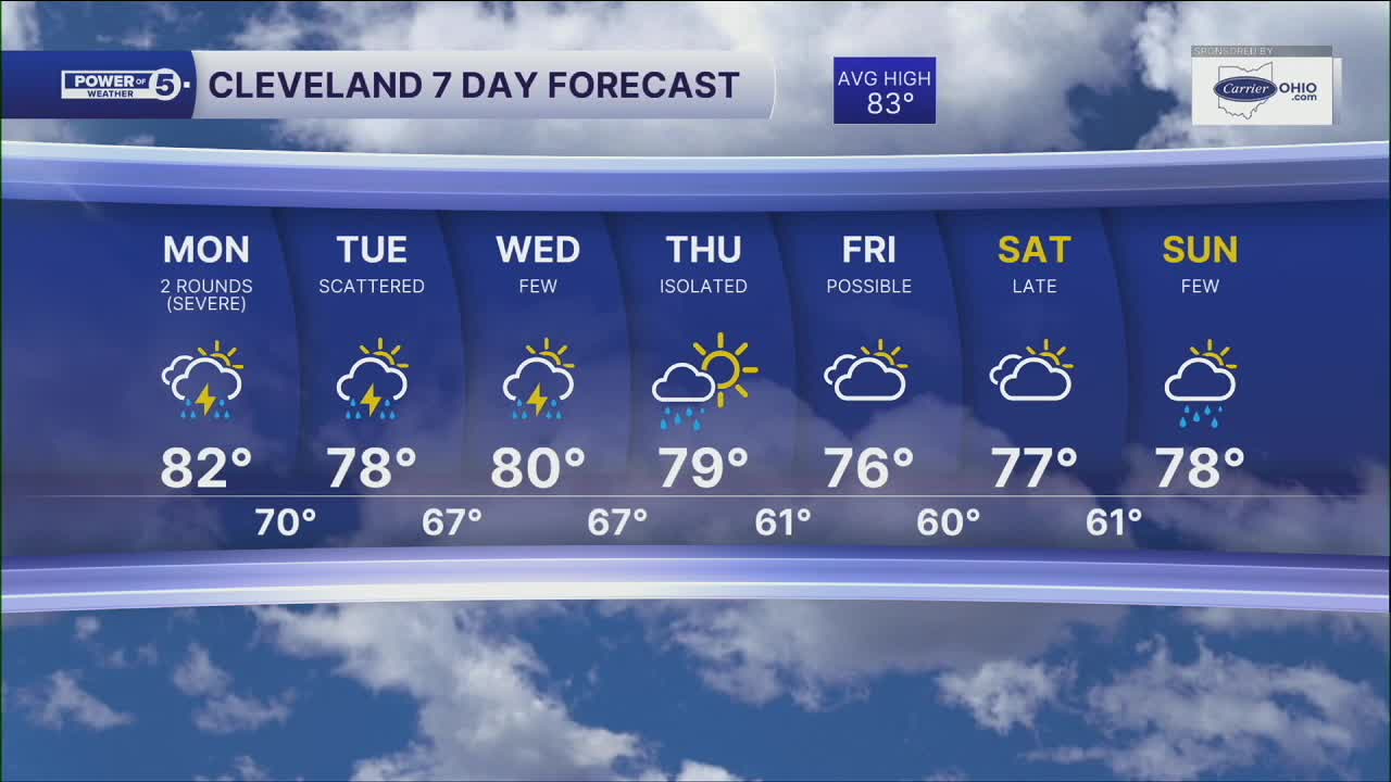
Additional rain and storm chances return Monday as another weather system moves through the region. There is already a risk posted from the Storm Prediction Center for all of NEO on Monday, meaning damaging storms will be possible. Keep this in mind as we start the new week! Lingering storm chances will continue to be possible again next week, so keep the umbrella handy!
5-Day Forecast
Monday: Morning downpours, afternoon storms, severe possible. | High: 86º
Tuesday: A few lingering t-storms. | High: 79º
Wednesday: A few showers, cooler. | High: 77º
Thursday: Isolated rain, cool. | High: 75º
Learn the lingo: The Power of 5 Weather Team wants to get you your forecast closer to home. We have broken NEO into 5 separate and distinct regions. Find your region to get your hyper-local forecast!
- Cleveland Metro Region: Cuyahoga County. This region includes cities such as Cleveland, Parma, Westlake, Berea, Strongsville, Independence, Solon, Beachwood and Euclid.
- Snowbelt Region: Lake, Geauga and Ashtabula Counties. This includes cities such as Mentor, Geneva, Ashtabula, Bainbridge, Chardon, Burton and Orwell.
- Akron-Canton Region: Summit, Stark and Portage Counties. This region includes cities such as Akron, Canton, Hudson, Ravenna, Mantua, Alliance, and Canal Fulton.
- West Region: Lorain, Medina, Erie, Huron, Richland and Ashland Counties. This region includes cities such as Lorain, Wellington, Medina, Lodi, Ashland, Mansfield, Willard, and Sandusky.
- South Region: Wayne, Holmes, Tuscarawas, Carroll Counties. This region includes Wooster, Millersburg, New Philadelphia, Strasburg, Mineral City, Carrollton, and Newcomerstown
Want the latest Power of 5 weather team updates wherever you go? Download the News 5 App free now: Apple|Android
Click here to view our interactive radar.
Follow the News 5 Weather Team:
Trent Magill: Facebook & Twitter
Katie McGraw: Facebook & Twitter
Phil Sakal: Facebook & Twitter
Allan Nosoff: Facebook & Twitter
