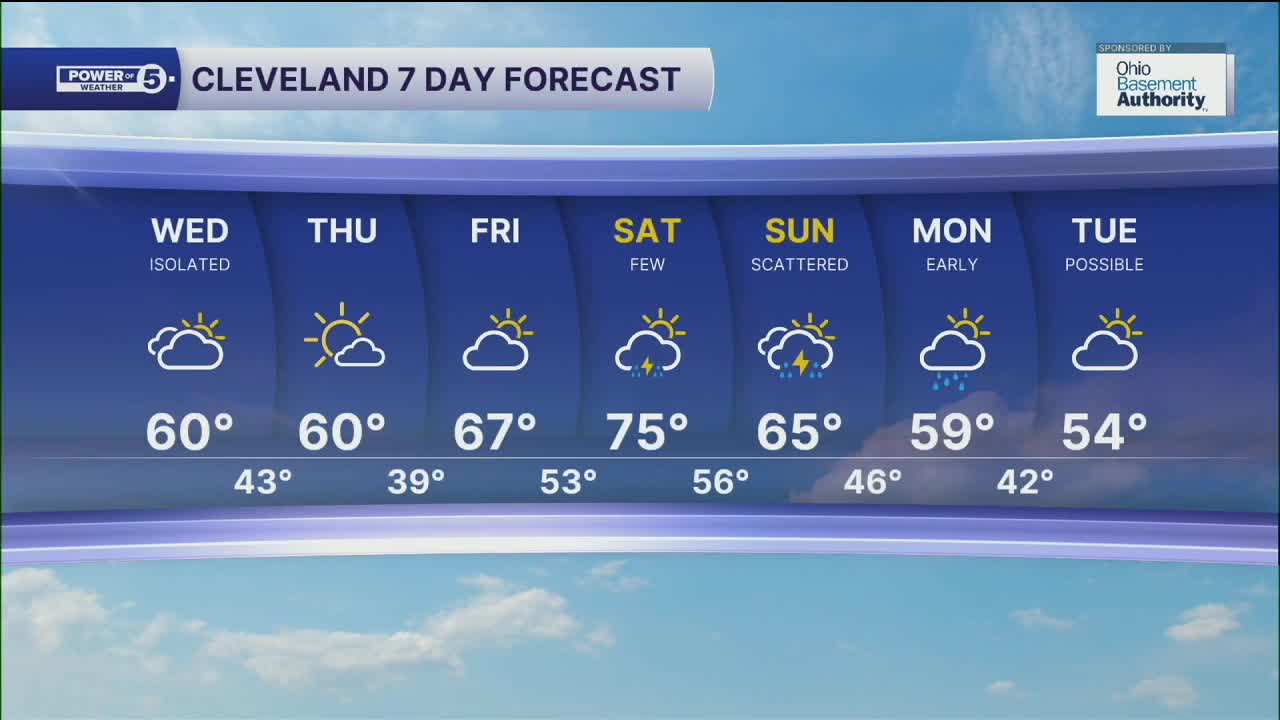


CLEVELAND — An isolated shower chance moves in for the start of Wednesday; otherwise, anticipate more clouds for your mid-week. Most areas will see temperatures a couple of degrees below average on Wednesday afternoon, as highs reach the lower 60s.
Cooler air moves in for the start of the day on Thursday, with some areas potentially seeing patchy frost, as temperatures will be in the upper 30s and lower 40s. Highs will once again struggle to warm past 60 on Thursday afternoon, despite seeing sunshine across the region.
Temperatures will bump back up to round out the work week, as highs will top off in the mid to upper 60s on Friday, under partly sunny skies. Ahead of a cold front, temperatures will be even warmer to begin the weekend, with highs in the mid 70s on Saturday. The front will usher in better rain chances by late afternoon through Sunday, which could impact the Browns game on Sunday afternoon. Cooler air will filter in for the start of the new work week, as highs fall into the mid to upper 50s, along with a few lingering rain chances on Monday and Tuesday.
DAILY FORECAST:
Wednesday: Isolated AM rain showers possible. Cooler | High: 60º
Thursday: Sun returns but temps struggle. | High: 60º
Friday: Partly sunny. Not as cool. | High: 67º
Saturday: T'showers possible late. Warmer. | High: 75º
Sunday: Scattered t'showers. Cooler. | High: 65º
Monday: Early shower chance. Cooler again. | High: 59º
Want the latest Power of 5 weather team updates wherever you go? Download the News 5 App free now: Apple|Android
Click here to view our interactive radar.
Follow the News 5 Weather Team:
Trent Magill: Facebook & Twitter
Katie McGraw: Facebook & Twitter
Phil Sakal: Facebook & Twitter
Allan Nosoff: Facebook & Twitter
