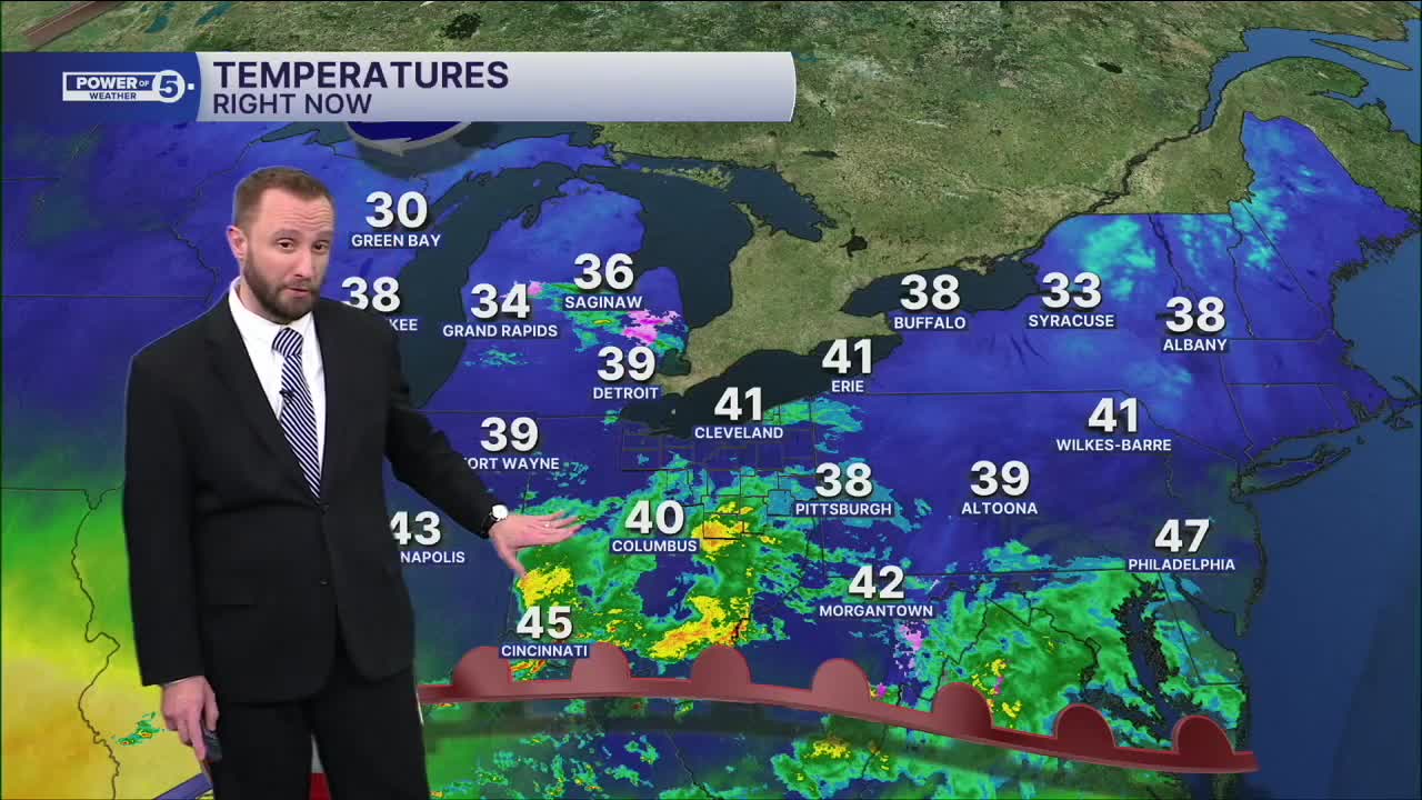


CLEVELAND — Some patchy fog will be possible into the morning on Wednesday. Will need the winter coats to begin the day with most in the mid-30s.
More clouds, but drier conditions are on tap for your Wednesday, along with slightly warmer temperatures. Highs will warm into the mid 40s for most, which is still a few degrees shy of par for this time of the year.
Temperatures will bump a few degrees for the end of the week, with highs in the lower 50s by Friday. Rain chances begin to return with the warmer air, with best chances to the south of Greater Cleveland on Friday and early Saturday.
We dry out for the second half of the weekend, but rain chances don't stay away for long. Could need the umbrella again by Tuesday.
DAILY FORECAST:
Wednesday: Dry again. Mostly cloudy. Not as chilly. | High: 46º
Thursday: Isolated showers possible late. Seasonable and breezy. | High: 52º
Friday: More rain, especially south. Warm and breezy. | High: 53º
Saturday: Mostly cloudy. Drying out. Cooler. | High: 47º
Want the latest Power of 5 weather team updates wherever you go? Download the News 5 App free now: Apple|Android
Click here to view our interactive radar.
Follow the News 5 Weather Team:
Trent Magill: Facebook & Twitter
Katie McGraw: Facebook & Twitter
Phil Sakal: Facebook & Twitter
Allan Nosoff: Facebook & Twitter
