


CLEVELAND — Plan for another steamy day on Wednesday, with temperatures in the mid-to-upper 80s and dew points well into the 70s. Dew points that high make it feel even hotter outside. It is the kind of air that you wear! If you are hoping for some relief from the heat...you are in luck!
A cold front is expected to move through mid-week. Most of Wednesday looks dry, that is, until Wednesday night. The best chance for storms this week is on Thursday. We will be watching for any strong or severe storms as the front slides through NEO.
The cold front will live up to its name and will bring significantly cooler and more comfortable air by the end of next week and continuing into the weekend.
The weekend looks FANTASTIC - dry, not too hot or humid!
DAILY FORECAST:
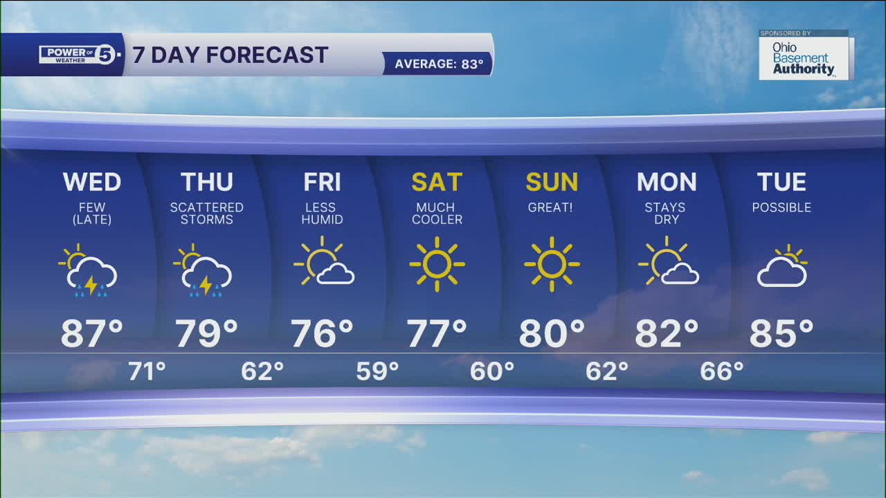
Tuesday Night: Super muggy, quiet. | Low: 70º
Wednesday: Still hot & humid with scattered storms late in the day. | High: 87º
Thursday: Storms ending early, staying cooler after. | High: 79º
Friday: More sunshine & comfortable. | High: 76º
Saturday: Sunny and pleasant. | High: 77º
Download the News 5 app for the latest weather updates:
Follow the News 5 Weather Team:
Trent Magill: Facebook & Twitter
Katie McGraw: Facebook & Twitter
Phil Sakal: Facebook & Twitter
