


CLEVELAND — A couple of storms are possible this evening/tonight, especially closer to the lake, and look to fade overnight. However, rain and storm chance ramps up again on Friday.
A few showers are possible early on Friday, and then more storms are expected during the afternoon and evening. Storms should fade by Friday evening, but then those storms will return on Saturday again. It looks like Friday's and Saturday's rain will be more widespread and potentially heavier. That means the flood threat is elevated.
We will be watching the radar carefully for any strong or severe storms on Friday, Saturday, and Sunday, including strong wind gusts, heavy rain, and frequent lightning.
It will still be very warm and humid during this time as well, but it does not look *as* hot due to the storm potential.
DAILY FORECAST:
Thursday night: Couple of storms (mainly north). Very mild.| Low: 75º
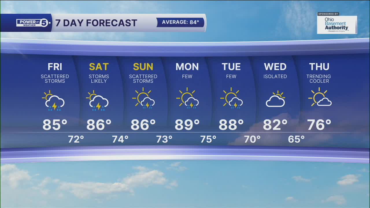
Friday: Hot with scattered storms. | High: 85º
Saturday: Humid with more storms. | High: 86º
Sunday: Scattered storms. Warm & muggy. | High: 84º
Monday: Few storms. Warm & muggy. | High: 84º
Download the News 5 app for the latest weather updates:
Follow the News 5 Weather Team:
Trent Magill: Facebook & Twitter
Katie McGraw: Facebook & Twitter
Phil Sakal: Facebook & Twitter
