


CLEVELAND — Reminder: The time change is this weekend. We "fall back" on Sunday at 2 am. The sunset will be around 5:20 pm on Sunday.
It will be dry and even sunnier on Sunday with highs in the mid to upper 50s.
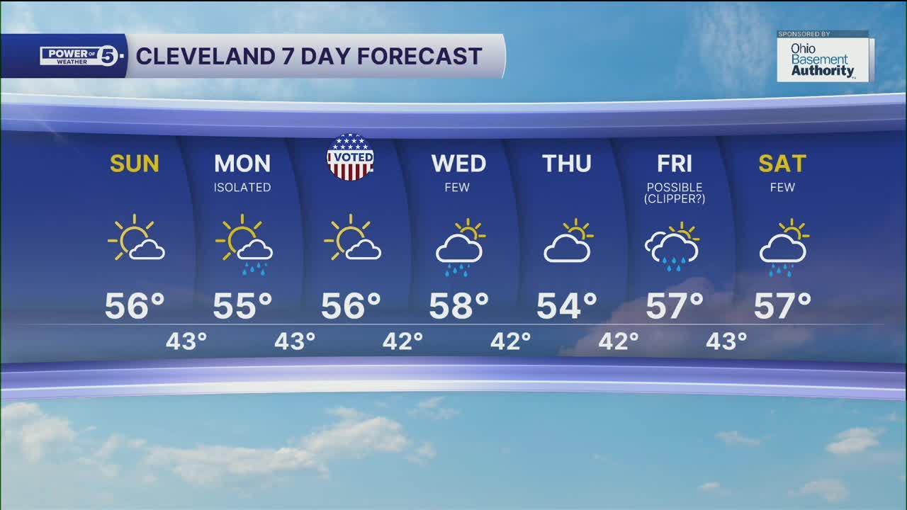
Winter is coming! And so are not one, not two, but three clippers next week. They typically bring snow during the winter, but these will bring a few isolated rain showers on Monday, with a better shot at rain on Wednesday and again on Friday.
DAILY FORECAST:
Sunday: Partly cloudy and seasonable. | High: 57º
Monday: Isolated showers. Seasonable. | High: 55º
Election Day: Mostly sunny and cool. | High: 56º
Wednesday: Few showers. Mostly cloudy. | High: 58º
Thursday: Partly sunny. Dry. | High: 54º
Friday: Showers possible. | High: 57º
Saturday: Few showers. | High: 57º
Want the latest Power of 5 weather team updates wherever you go? Download the News 5 App free now: Apple|Android
Click here to view our interactive radar.
Follow the News 5 Weather Team:
Trent Magill: Facebook & Twitter
Katie McGraw: Facebook & Twitter
Phil Sakal: Facebook & Twitter
Allan Nosoff: Facebook & Twitter
