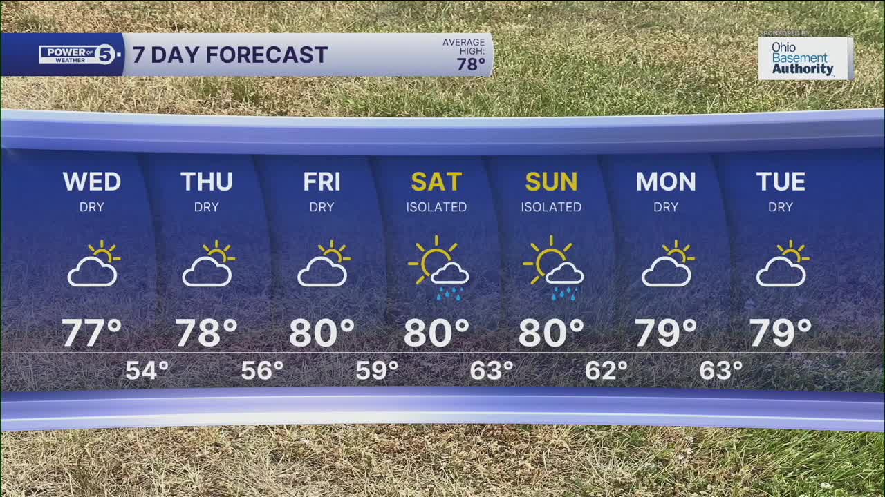


CLEVELAND — We're back! Back to typical September weather that is! Temperatures made it back into the 70s on Tuesday, and 80s are not far behind. Plan for seasonable temperatures near 80 degrees all week!
Tonight will be quiet and cool...but not *AS* cool as the last two mornings, but only by a couple of degrees. Plan for low 50s along the lakeshore to the mid and upper 40s inland with a few clouds. After a cool start to the day, temperatures will jump back to mid and upper 70s for much of the area.
We are also not tracking rain for the next several days. However, we are actually in need of rain across NEO. Drought has returned for portions of the area, and this drought will likely worsen over the next week with limited rain chances.
The next sliver of a *chance* is not until this weekend, and those looks very isolated and light. Rain totals over the next week are only hundredths of an inch! Over the last day, rain chances backed off even more, and we are still several days out. We will keep you posted on the likelihood of those showers occurring throughout the rest of the week.
In the meantime, enjoy the dry time and soak up some outdoor fun.
DAILY FORECAST:
Tuesday night: Few clouds. Cool temps. | High: 78º
Wednesday: Mostly sunny and even warmer. | High: 79º
Thursday: Partly sunny and seasonable. | High: 78º
Friday: Partly sunny. Right on Par. | High: 77º
Saturday: Partly sunny and a touch warmer.| High: 81º
Sunday: More clouds. Rain showers are possible. | High: 77º
Want the latest Power of 5 weather team updates wherever you go? Download the News 5 App free now: Apple|Android
Click here to view our interactive radar.
Follow the News 5 Weather Team:
Trent Magill: Facebook & Twitter
Katie McGraw: Facebook & Twitter
Phil Sakal: Facebook & Twitter
Allan Nosoff: Facebook & Twitter
